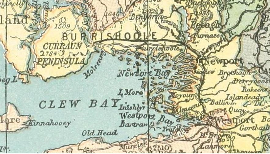

Clew bay-old map
map of Clew Bay, Western Ireland around 1890
- Date
- May 12, 2012
- Mapmaker / publisher
- Patrick Weston Joyce
- Place
- County Mayo
- Archive
- Wikimedia Commons
- Type
- map
- Original size
- 882 × 502 pixels
Public domain
Reason: a US government work.
This status rests on the map's publication history, as researched by Wikimedia Commons. Check it before commercial use.
Read from: Commons licence category: PD US; no CC BY, CC BY-SA, GFDL or deletion tag on the file page; Commons tags it as a US government work, but its record names no government maker.
Credit line
"Clew bay-old map" (May 12, 2012). Patrick Weston Joyce, via Wikimedia Commons. Public domain. https://commons.wikimedia.org/wiki/File:Clew_bay-old_map.jpgNeed maps for a whole project? Add Find Any Map to Claude and ask for this one by its id: 245570.
More like this

Baronies of Mayo
1900 · Wikimedia Commons

Baronies of Galway
1900 · Wikimedia Commons

GRIBAYÈDOFF(1890) p141 Map of Connaught
1890 · Wikimedia Commons

Map of ERRIS and GALWAY
1851 · Wikimedia Commons

Map of Ireland
1894 · Wikimedia Commons

PRENDERGAST(1870) p 438 Map of Connaught, as laid out to receive the Inhabitants from the several Counties ofthe other Provinces, A.D. 1654
1870 · Wikimedia Commons

The Sunny Side of Ireland. How to see it by the Great Southern and Western Railway. With seven maps and over 130 illustrations, etc" Author: O'MAHONY, John. Shelfmark: "British Library HMNTS 10390.bbb.32." Page: 20 Place of Publishing: Dublin Date of Publishing: 1898 Publisher: A. Thom & Co. Issu
1898 · Wikimedia Commons

BAGWELL(1890) p 3.049 Munster with Adjacent Districts
1890 · Wikimedia Commons