

Clerkenwell 1805 Cartographer; Tyrer, James
- Date
- 1805
- Place
- London
- Archive
- Wikimedia Commons
- Type
- map
- Original size
- 712 × 758 pixels
Public domain
Reason: its maker died long enough ago that the copyright has expired.
This status rests on the map's publication history, as researched by Wikimedia Commons. Check it before commercial use.
Read from: Commons licence category: PD Old; no CC BY, CC BY-SA, GFDL or deletion tag on the file page.
Credit line
"Clerkenwell 1805 Cartographer; Tyrer, James" (1805). Wikimedia Commons. Public domain. https://commons.wikimedia.org/wiki/File:Clerkenwell_1805_Cartographer;_Tyrer,_James.jpgNeed maps for a whole project? Add Find Any Map to Claude and ask for this one by its id: 291752.
More like this

The Parish of St James Clerkenwell Taken from ye last Survey With Corrections
1720 · BM Heal,Topography.205
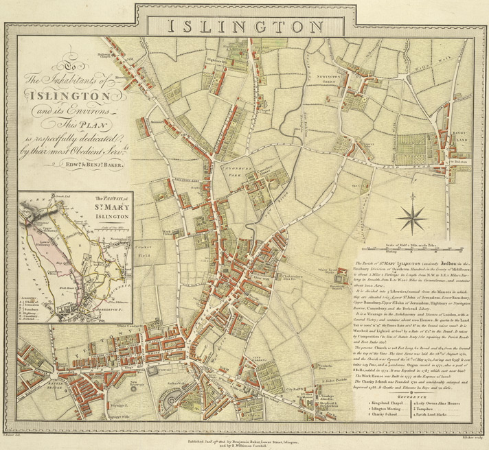
Islington E Baker 1805
1805 · Wikimedia Commons

A Map of St Sepulchers without Charterhouse Liberty and Clarkenwell Parish
1755 · BM Heal,Topography.206

A new Plan of London and Westminster with the borough of Southwark 1825, published by James Wyld,.
1825 · Wikimedia Commons

Sheet 5 from- An exact survey of the cities of London and Westminster, the Borough of Southwark, with the country near ten miles round RMG K1131
1746 · Wikimedia Commons

Survey of the Roads and Foot paths in the Parish of Islington
1811 · Wikimedia Commons

North Southwark 1830
1830 · Wikimedia Commons

A Map of St Giles's Cripple Gate without with large additions and corrections
1720 · BM Heal,Topography.207