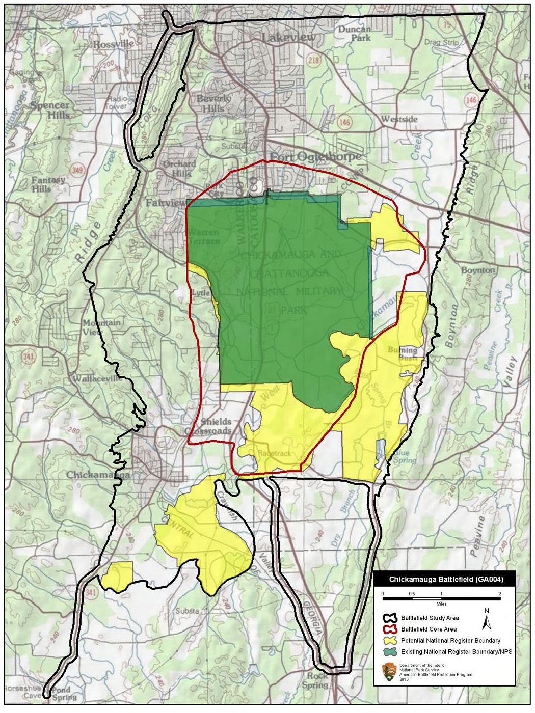

Chickamauga Battlefield Georgia
Map of battlefield core and study areas. The ABPP revised the 1993 Study Area and Core Area to more accurately reflect the locations of significant events and landscape features associated with the battle. The boundaries were adjusted to show the rough terrain of the Crawfish Valley, where Confederate forces from Lafayette turned on the advancing Army of the Cumberland and drove the Federal army back to Chattanooga.
- Date
- June 23, 2010
- Mapmaker / publisher
- American Battlefield Protection Program
- Archive
- Wikimedia Commons
- Type
- map
- Original size
- 1,050 × 1,400 pixels
Public domainsafest
Reason: a US government work.
Read from: Commons licence category: PD US Government; no CC BY, CC BY-SA, GFDL or deletion tag on the file page.
Credit line
"Chickamauga Battlefield Georgia" (June 23, 2010). American Battlefield Protection Program, via Wikimedia Commons. Public domain. https://commons.wikimedia.org/wiki/File:Chickamauga_Battlefield_Georgia.jpgNeed maps for a whole project? Add Find Any Map to Claude and ask for this one by its id: 1005.
More like this

Rocky Face Ridge Battlefield Georgia
June 23, 2010 · Wikimedia Commons

Davis' Cross Roads Battlefield Georgia
June 23, 2010 · Wikimedia Commons

Dalton I Battlefield Georgia
June 23, 2010 · Wikimedia Commons

Allatoona Battlefield Georgia
June 23, 2010 · Wikimedia Commons

Kennesaw Mountain Battlefield Georgia
June 23, 2010 · Wikimedia Commons

Peachtree Creek Battlefield Georgia
June 23, 2010 · Wikimedia Commons

Dallas Battlefield Georgia
June 23, 2010 · Wikimedia Commons

Kolb's Farm Battlefield Georgia
June 23, 2010 · Wikimedia Commons