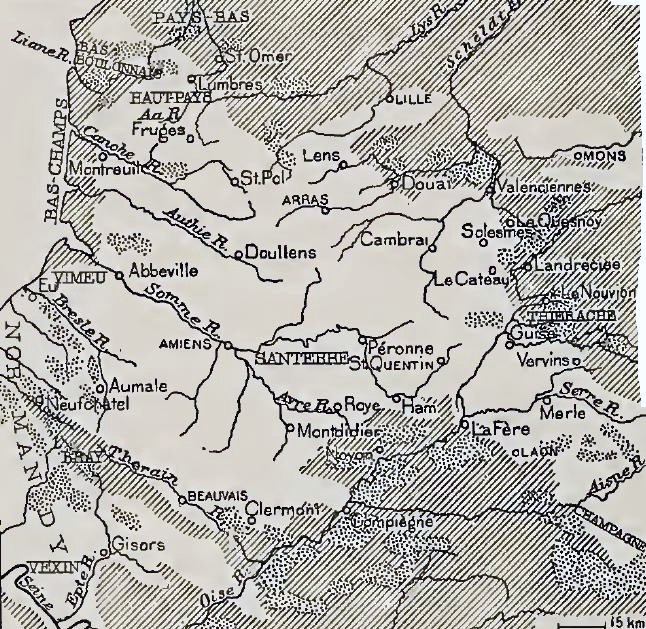

Chalk areas, northern France
Chalk areas
- Mapmaker / publisher
- Author: Johnson, Douglas Wilson, 1878-1944
- Archive
- Wikimedia Commons
- Type
- map
- Original size
- 646 × 629 pixels
Public domain
Reason: a US government work.
This status rests on the map's publication history, as researched by Wikimedia Commons. Check it before commercial use.
Read from: Commons licence category: PD US; no CC BY, CC BY-SA, GFDL or deletion tag on the file page.
Credit line
"Chalk areas, northern France". Author: Johnson, Douglas Wilson, 1878-1944, via Wikimedia Commons. Public domain. https://commons.wikimedia.org/wiki/File:Chalk_areas,_northern_France.jpgNeed maps for a whole project? Add Find Any Map to Claude and ask for this one by its id: 22821.
More like this

Artois, northern France
Wikimedia Commons

Geological cross-section Somme area
Wikimedia Commons

High ground, Artois
Wikimedia Commons

Somme relief map
Wikimedia Commons

Topography, Flanders and Artois
Wikimedia Commons

Topography of Barrois, Meuse, Moselle and Saffais plateaux
Wikimedia Commons

Arras and Vimy ridge features
Wikimedia Commons

Flanders plain
Wikimedia Commons