

Carte ethnographique de la Péninsule des Balkans
Prime meridian: Paris.
- Date
- 1918
- Mapmaker / publisher
- Cvijić, Jovan
- Place
- Europe
- Archive
- Library of Congress (via Wikimedia Commons)
- Type
- map
- Original size
- 6,319 × 5,758 pixels
Public domainsafest
Reason: its maker died more than 80 years ago.
Read from: Commons licence category: PD-old-80-expired; no CC BY, CC BY-SA, GFDL or deletion tag on the file page.
Credit line
"Carte ethnographique de la Péninsule des Balkans" (1918). Cvijić, Jovan. Library of Congress, Geography and Map Division, via Wikimedia Commons. Public domain. https://commons.wikimedia.org/wiki/File:Carte_ethnographique_de_la_P%C3%A9ninsule_des_Balkans_LOC_2007627465.jpgNeed maps for a whole project? Add Find Any Map to Claude and ask for this one by its id: 10249.
More like this

Ethnographic map of the Balkan Peninsula
1918 · Library of Congress

Zones of civilization of the Balkan Peninsula
1918 · Library of Congress

Balkan map 1910 Adolf Marx
1910 · Wikimedia Commons
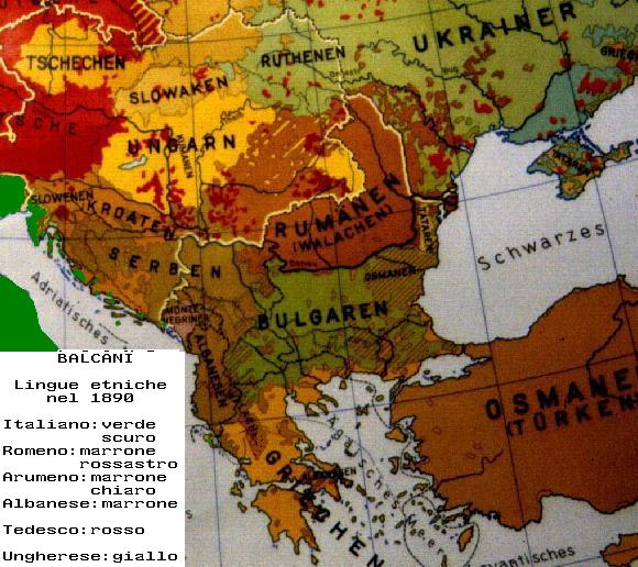
Balcani etnici 1890
1890 · Wikimedia Commons

Balkan peninsula before the Balkan Wars.
1878–1885 · Wikimedia Commons

Ethnic map of Balkan peninsula, 1861, by G. Lejean (french)
1861 · Wikimedia Commons

Ethnographical map of Central & South Eastern Europe
Wikimedia Commons

Hellenism in the Near East
Wikimedia Commons