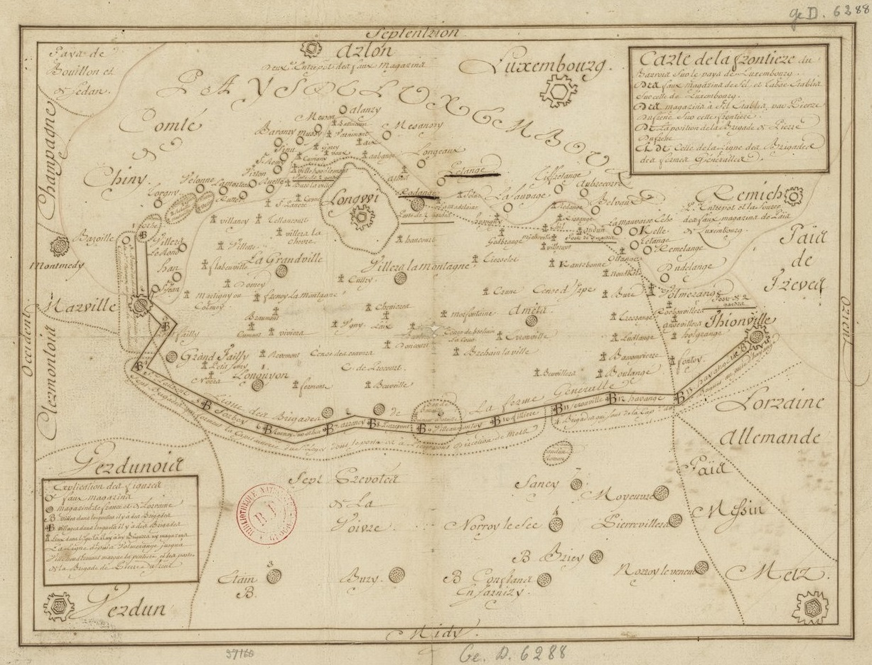

Carte de la frontière du Barrois sur le pays de Luxembourg 1775
- Date
- 1775
- Mapmaker / publisher
- s.n
- Place
- Lorraine
- Archive
- Wikimedia Commons
- Type
- map
- Original size
- 1,227 × 936 pixels
Public domainsafest
Reason: its maker died more than 70 years ago.
Read from: Commons licence category: PD-old-70-expired; no CC BY, CC BY-SA, GFDL or deletion tag on the file page; permission field: Droits : domaine public..
Credit line
"Carte de la frontière du Barrois sur le pays de Luxembourg 1775" (1775). s.n, via Wikimedia Commons. Public domain. https://commons.wikimedia.org/wiki/File:Carte_de_la_fronti%C3%A8re_du_Barrois_sur_le_pays_de_Luxembourg_1775.jpgNeed maps for a whole project? Add Find Any Map to Claude and ask for this one by its id: 251084.
More like this

Carte du pays compris entre les villes de Sierques, Remich, Trèves, Berncastel et Trärbach
1737 · RES CAR Rol 007

Charte vom Herzogthum Luxemburg / nach der grossen Ferrarischen Charte von den Niederlanden und astronomischen Obserwationen entworfen von F.L.Grüssefeld,.
1791 · Wikimedia Commons

Carte de France divisée en XXXI gouvernements militaires et en ses provinces, dressée sur les meilleures cartes qui ont paruës jusqu'à présent et sur la carte des triangles en XVIII petites feuilles, levée géométriquement par ordre du Roi, et mise au jour par Mr. Cassini de Thury,. Dédiée et prés
1756 · Hesse, plate 4 of 28

Le Comté de Namur, partie de l'Evesché de Liège, du Luxembourg, &c. Par le Sr. Jaillot, geographe du Roy
1705 · Plate 2 of 3

Atlas nouveau portatif à l'usage des militaires, colleges et du voyageur. Tome 1.er, Contenant 91 cartes dressées sur les nouvelles observations
Wikimedia Commons

Atlas ou recüeil de cartes geographiques, dressées sur les nouvelles observations de M essieu rs de l'Academie Royale des Sciences, par N. de Fer geographe de sa Majesté Catolique et Monseigneur le Dauphin
1709–1725 · Luxembourg, plate 142 of 328

Carte générale et particulière du cours des Geetes, des environs de Tirlemont, St Tronc, Leuve, Judoigne et Lenden
Wikimedia Commons

Représentation géométrique des limittes de Clèves, de la Gueldre hollandaise, du comté de Zutphen et de l'évêché de Münster à l'orient du Rhin et sur la rive droitte.
1762 · Wikimedia Commons