

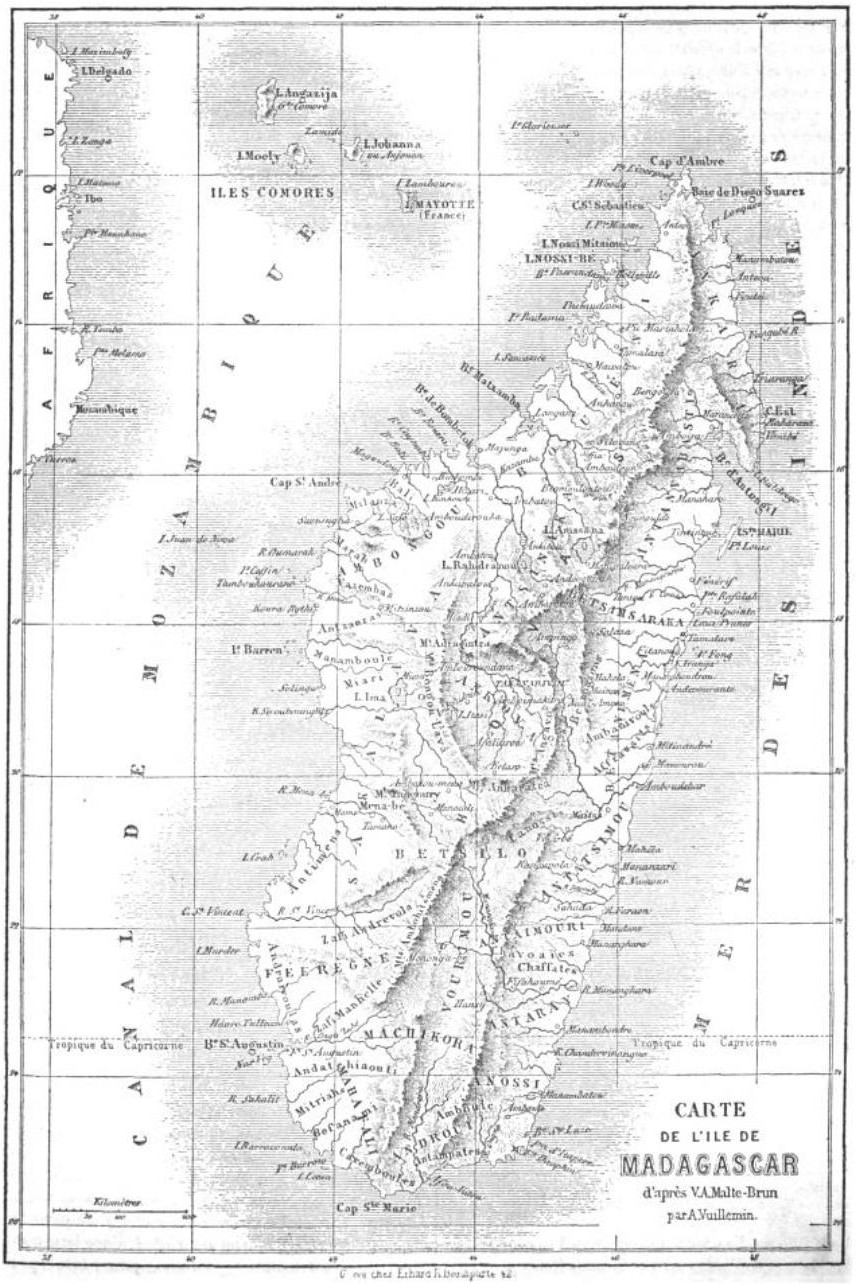
Carte de l'Ile de Madagascar
1:3,400,000; 11x17
- Date
- 1846
- Place
- Madagascar
- Archive
- Wikimedia Commons
- Type
- map
- Original size
- 776 × 1,000 pixels
Public domain
Reason: a US government work.
This status rests on the map's publication history, as researched by Wikimedia Commons. Check it before commercial use.
Read from: Commons licence category: PD US; no CC BY, CC BY-SA, GFDL or deletion tag on the file page.
Credit line
"Carte de l'Ile de Madagascar" (1846). Wikimedia Commons. Public domain. https://commons.wikimedia.org/wiki/File:Carte_de_l%27Ile_de_Madagascar_-_DPLA_-_df1ad1eec19b9393bcf44ec6ec38a351.jpgNeed maps for a whole project? Add Find Any Map to Claude and ask for this one by its id: 238942.
More like this

Sketch of Madagascar to illustrate Colonel Llyods Paper
1850 · Wikimedia Commons

Carte de l'Isle de Madagascar
1764 · Wikimedia Commons
Le Tour du monde-04-p339
July 1, 1861 · Madagascar, plate 339

Map of Madagascar. From: Memoir on Madagascar
1850 · Wikimedia Commons

Isle de Madagascar.
1685 · Wikimedia Commons

Carte de l'île de Madagascar. / par V. A. Malte-Brun; Gravé chez Erhard.
1859 · Wikimedia Commons

Carte particulière de l'Isle de Madagascar ou St. Laurens ou Dauphine
Wikimedia Commons

Physical Map of Madagascar
1879 · Wikimedia Commons