

Carte de l'ile de Cuba - redigée sur les observations astronomiques des navigateurs Espagnols et sur celles de Mr. de Humboldt
Relief shown by shading. Prime meridian: Paris. Inset shows city and harbor of Havana.
- Date
- 1820
- Mapmaker / publisher
- Lapie, (Pierre); Humboldt, Alexander Von; Lapie
- Place
- Cuba
- Archive
- Library of Congress (via Wikimedia Commons)
- Type
- map
- Original size
- 11,425 × 7,346 pixels
Public domainsafest
Reason: its maker died more than 100 years ago.
Read from: Commons licence category: PD-old-100-expired; no CC BY, CC BY-SA, GFDL or deletion tag on the file page.
Credit line
"Carte de l'ile de Cuba - redigée sur les observations astronomiques des navigateurs Espagnols et sur celles de Mr. de Humboldt" (1820). Lapie, (Pierre); Humboldt, Alexander Von; Lapie. Library of Congress, Geography and Map Division, via Wikimedia Commons. Public domain. https://commons.wikimedia.org/wiki/File:Carte_de_l%27ile_de_Cuba_-_redig%C3%A9e_sur_les_observations_astronomiques_des_navigateurs_Espagnols_et_sur_celles_de_Mr._de_Humboldt_LOC_2010587905.jpgNeed maps for a whole project? Add Find Any Map to Claude and ask for this one by its id: 10079.
More like this

Carta Maritima de la Isla de Cuba, que Comprehende las Juridicciones de Filipina, la Havana, las quatro Villas, la de la Villa del Puerto del Principe, el Bayamo y la de la Ciudad de Cuba
1825 · Library of Congress

Carte de l'ile de Cuba, redigée sur les observations astronomiques des navigeurs espagnols et sur celles de Mr. de Humboldt
Wikimedia Commons

Carte réduite de l'isle de Cube.
1807 · Library of Congress

Map of the island of Cuba - compiled from the most reliable Spanish authorities.
1855 · Library of Congress
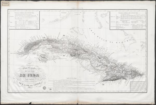
Plano geografico de la isla de Cuba para servir de illustracion a la historia fisica, politica y natural de la misma isla
Wikimedia Commons

Isles de Cuba et de la Jamaïque.
1788 · Library of Congress

Kaart van het eiland Cuba.
1785 · Library of Congress

Isle de Cube.
1764 · Library of Congress