

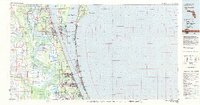
Cape Canaveral, Florida - coast chart no. 61
Scale 1:80,000. Facsim. of nautical chart originally "Issued March 1883." Relief shown by hachures. Depths shown by contours and soundings. "No. 161." "BiC-38." Includes sailing information. AACR2
- Date
- 1976
- Mapmaker / publisher
- U.S. Coast And Geodetic Survey; National Ocean Survey
- Place
- Florida
- Scale
- 1:80,000
- Archive
- Library of Congress (via Wikimedia Commons)
- Type
- chart
- Original size
- 10,166 × 11,196 pixels
Public domainsafest
Reason: a US government work.
Read from: Commons licence category: PD US Government; no CC BY, CC BY-SA, GFDL or deletion tag on the file page.
Credit line
"Cape Canaveral, Florida - coast chart no. 61" (1976). U.S. Coast And Geodetic Survey; National Ocean Survey. Library of Congress, Geography and Map Division, via Wikimedia Commons. Public domain. https://commons.wikimedia.org/wiki/File:Cape_Canaveral,_Florida_-_coast_chart_no._61_LOC_79695308.jpgNeed maps for a whole project? Add Find Any Map to Claude and ask for this one by its id: 9883.
More like this

Canaveral and Merritt Island
1996 · Library of Congress

Canaveral and Merritt Island
1993 · Library of Congress
Cape Canaveral, Florida: USGS topographic map, 1:100,000 (1981)
1981 · USGS Historical Topographic Map Collection

Canaveral and Merritt Island
2000 · Library of Congress

Canaveral and Merritt Island
1997 · Library of Congress

Canaveral and Merritt Island
1995 · Library of Congress

Canaveral National Seashore, Florida, Merritt Island National Wildlife Refuge, Florida.
1980 · Library of Congress

Canaveral and Merritt Island - National Seashore, National Wildlife Refuge, Florida
2001 · Library of Congress