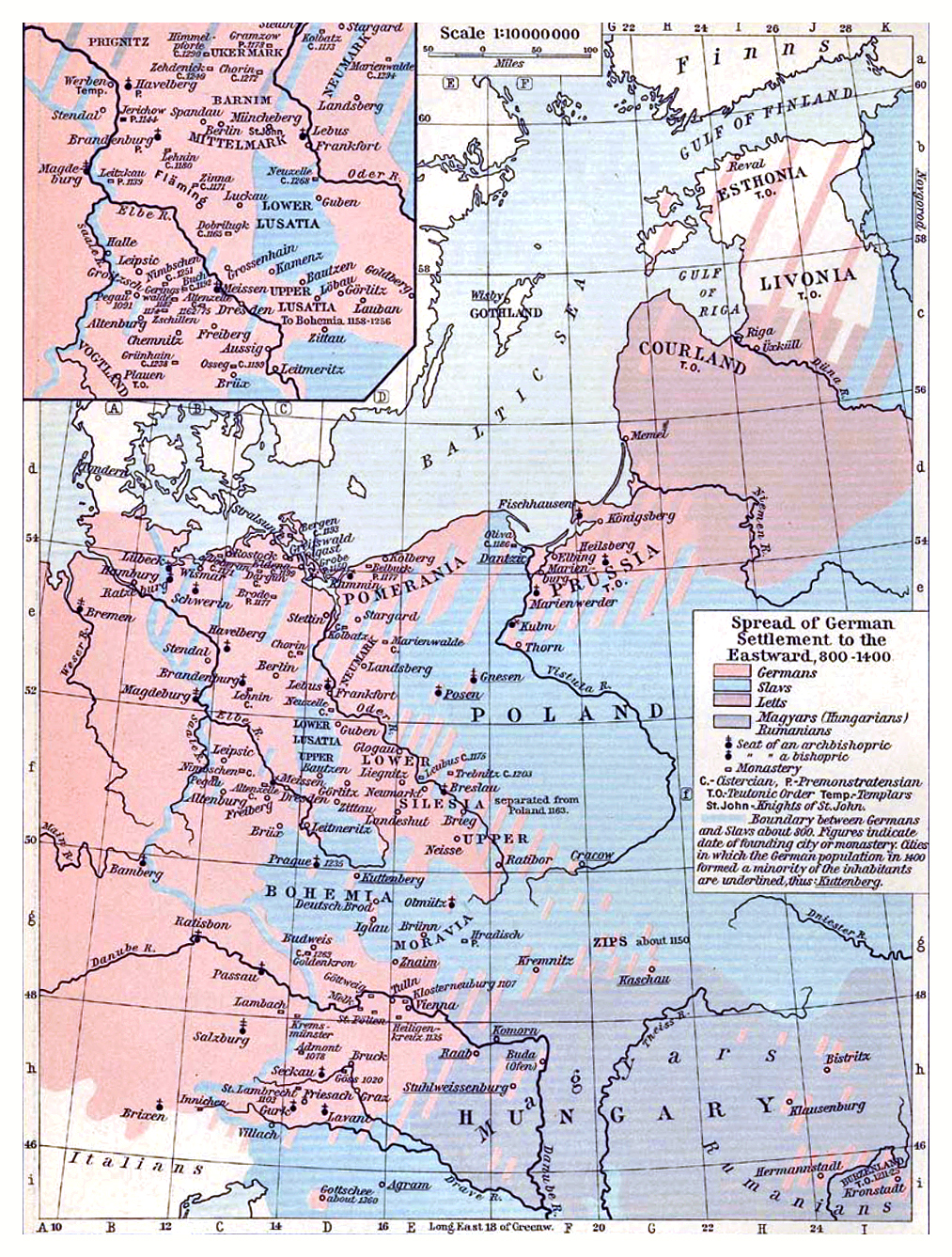

C. 1400 Europe (Northeastern)
Map of Northeastern Europe circa 1400 CE
- Date
- c. 1911
- Place
- Central Europe in the 14th century
- Archive
- Wikimedia Commons
- Type
- atlas page
- Original size
- 1,013 × 1,337 pixels
Public domainsafest
Reason: its maker died more than 90 years ago.
Read from: Commons licence category: PD-old-90-expired; no CC BY, CC BY-SA, GFDL or deletion tag on the file page.
Credit line
"C. 1400 Europe (Northeastern)" (c. 1911). Wikimedia Commons. Public domain. https://commons.wikimedia.org/wiki/File:C._1400_Europe_(Northeastern).jpgNeed maps for a whole project? Add Find Any Map to Claude and ask for this one by its id: 20600.
More like this

C. 1400 Northern Europe Hanseatic League
c. 1886 · Wikimedia Commons

C. 1378 Central Europe
c. 1911 · Wikimedia Commons

Teutonic Order in the 14th century
1905 · Wikimedia Commons

C. 1477 Central Europe
c. 1911 · Wikimedia Commons

Deutschland im XIV. Jahrhundert
1886 · Wikimedia Commons

Deutschland im XIV. Jahrhundert (Putzger)
1902 · Wikimedia Commons

F.W. Putzgers Historischer Schul-Atlas: zur alten, mittleren und neuen Geschichte: in 66 Haupt- und 63 Nebenkarten
Wikimedia Commons

C. 1500 Scandinavia and Baltics
1903 · Wikimedia Commons