

C. 1360 Europe and Western Asia
Map of Europe and Western Asia circa 1360 CE. Territories shown: Anatolia, Seljuk Empire, Golden Horde, Byzantine Empire, Cyprus, Levant, Jalayerid dynasty, Mamluk Sultanate (Cairo), Hafsid dynasty, Marinid dynasty, Zayyanid dynasty, Iberia, Granada, Spain, Portugal, Castile, Navarre, Aragon, France, Aquitaine, Holy Roman Empire, Burgundy, Republic of Venice, Papal States, Naples, Lorraine, Rhineland, Thuringia, Saxony, Bavaria, Bohemia and Moravia, Pomerania, Prussia, Teutonic Order, Poland, Lithuania, Baltic states, Scandinavia, Hungary, Bulgaria, Croatia, Serbia, Bosnia and Herzegovina, Albania, British Isles, Armenia, Georgia, Provence, North Africa
- Date
- c. 1911
- Place
- Europe in the 14th century
- Archive
- Wikimedia Commons
- Type
- atlas page
- Original size
- 2,112 × 1,365 pixels
Public domain
Reason: its maker died long enough ago that the copyright has expired.
This status rests on the map's publication history, as researched by Wikimedia Commons. Check it before commercial use.
Read from: Commons licence category: PD Old; no CC BY, CC BY-SA, GFDL or deletion tag on the file page.
Credit line
"C. 1360 Europe and Western Asia" (c. 1911). Wikimedia Commons. Public domain. https://commons.wikimedia.org/wiki/File:C._1360_Europe_and_Western_Asia.jpgNeed maps for a whole project? Add Find Any Map to Claude and ask for this one by its id: 20599.
More like this

Angevin Europe 1360
1911 · Wikimedia Commons

C. 1378 Central Europe
c. 1911 · Wikimedia Commons

C. 814 Europe and Asia Minor
1894 · Wikimedia Commons

Europe about 1560
1923 · Wikimedia Commons

Deutschland im XIV. Jahrhundert
1886 · Wikimedia Commons
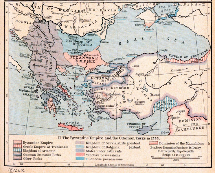
Byzantine Empire 1355
1911 · Wikimedia Commons