

Byzantine empire 1265 1355 shepherd
Perry-Castañeda Library Map Collection Historical Atlas by William R. Shepherd Complete contents of "Historical Atlas" by William R. Shepherd, New York, Henry Holt and Company, 1923 and editions as noted. Users can access the index to locate place names within the atlas. The 1911 edition of this atlas is also available.
- Date
- 1923
- Mapmaker / publisher
- William R. Shepherd
- Place
- the Byzantine Empire
- Archive
- Wikimedia Commons
- Type
- map
- Original size
- 863 × 723 pixels
Public domain
Reason: its maker died long enough ago that the copyright has expired.
This status rests on the map's publication history, as researched by Wikimedia Commons. Check it before commercial use.
Read from: Commons licence category: PD Old; no CC BY, CC BY-SA, GFDL or deletion tag on the file page.
Credit line
"Byzantine empire 1265 1355 shepherd" (1923). William R. Shepherd, via Wikimedia Commons. Public domain. https://commons.wikimedia.org/wiki/File:Byzantine_empire_1265_1355_shepherd.jpgNeed maps for a whole project? Add Find Any Map to Claude and ask for this one by its id: 245922.
More like this

Byzantine empire ottoman turks 1355 shepherd
1923 · Wikimedia Commons

C. 1265 Europe (Southeastern) and Byzantine Empire
c. 1911 · Wikimedia Commons

Balkans 1265
1911 · Wikimedia Commons

The Mediterranean Lands after 1204 by William R. Shepherd
1911 · Wikimedia Commons
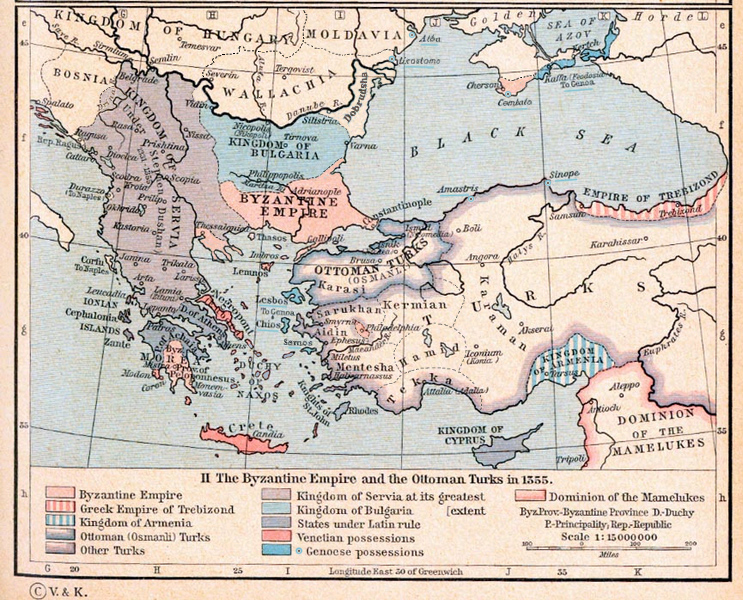
Byzantine Empire 1355
1911 · Wikimedia Commons

The Byzantine Empire and the Frankish states of Greece in 1265. Map from William R. Shepherd's Historical Atlas (1911)
December 30, 1911 · Wikimedia Commons

Ottoman dismemberment
1923 · Wikimedia Commons

Byzantine empire 1355
1911 · Wikimedia Commons