

Britannica North Anna
Map of the American Civil War Wilderness battlefield at North Anna on May 22, 1864, at 3 a.m.
- Date
- 1911
- Mapmaker / publisher
- From The Wilderness and Cold Harbor, by permission of Hugh Rees, Limited
- Place
- Virginia in the American Civil War
- Archive
- Wikimedia Commons
- Type
- map
- Original size
- 768 × 937 pixels
Public domain
Reason: public domain: Britannica.
This status rests on the map's publication history, as researched by Wikimedia Commons. Check it before commercial use.
Read from: Commons licence category: PD Britannica; no CC BY, CC BY-SA, GFDL or deletion tag on the file page.
Credit line
"Britannica North Anna" (1911). From The Wilderness and Cold Harbor, by permission of Hugh Rees, Limited, via Wikimedia Commons. Public domain. https://commons.wikimedia.org/wiki/File:Britannica_North_Anna.jpgNeed maps for a whole project? Add Find Any Map to Claude and ask for this one by its id: 588.
More like this

Britannica Spottsylvania May 12th
1911 · Wikimedia Commons

Britannica Totopotomoy and Cold Harbor
1911 · Wikimedia Commons

Britannica Wilderness
1911 · Wikimedia Commons

Карта к статье «Вильдернесс (лесное урочище)». Военная энциклопедия Сытина (Санкт-Петербург, 1911-1915)
1913 · Wikimedia Commons

Important operations in Virginia. The Army of the Potomac across the Rapidan-Scene of the impending conflict between Generals Grant and Lee.
1864 · Library of Congress
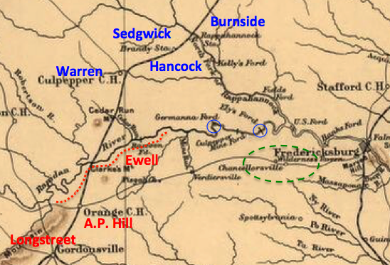
Wilderness VA May 2, 1864
1912 · Library of Congress

Map of the battle fields of North Anna - showing the field of operations of the Army of the Potomac commanded by Maj. Gen. George G. Meade U.S.A., from May 3d to 27th, 1864
1864 · Library of Congress

The Wilderness, May 5 & 6, 1864.
1895 · Library of Congress