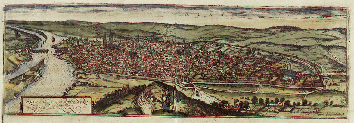

Braun Rouen HAAB
Rouen
- Mapmaker / publisher
- Georg Braun; Frans Hogenberg
- Place
- Rouen by Braun & Hogenberg
- Archive
- Wikimedia Commons
- Type
- map
- Original size
- 1,176 × 410 pixels
Public domain
Reason: its maker died long enough ago that the copyright has expired.
This status rests on the map's publication history, as researched by Wikimedia Commons. Check it before commercial use.
Read from: Commons licence category: PD Old; no CC BY, CC BY-SA, GFDL or deletion tag on the file page.
Credit line
"Braun Rouen HAAB". Georg Braun; Frans Hogenberg, via Wikimedia Commons. Public domain. https://commons.wikimedia.org/wiki/File:Braun_Rouen_HAAB.jpgNeed maps for a whole project? Add Find Any Map to Claude and ask for this one by its id: 303381.
More like this

Rhotomagus Galliae Lugdunensis ad Sequanam flu. opp. vulgo Rouen
1645 · Plate 1 of 2

Contrafactur und Beschreibung von den vornembsten Stetten der Welt. Liber tertius (page 22)
1582 · Wikimedia Commons

Civitates orbis terrarvm.
1612 · Rouen, plate 20

Rotomagus
Wikimedia Commons

Braun Lyon HAAB
Wikimedia Commons

Braun Magdeburg HAAB
Wikimedia Commons

Braun Poitiers HAAB
Wikimedia Commons

Rotomagus, vulgo Roan, Normandiae metropolis; Nemausus, Nismes civitas Narbonensis Galliae vestustissima; Civitatis Burdegalensis in Aquitanea.
1645 · Bordeaux, plate 1 of 2