

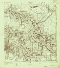
Boundaries between Brownsville, Texas and Matamoros, Tam. (Mexico)
Rio Grande between Matamoros, Tamaulipas showing monument on the Railroad Bridge.
- Date
- 1910
- Mapmaker / publisher
- International Boundary Commission, United States And Mexico
- Place
- Texas
- Archive
- Library of Congress (via Wikimedia Commons)
- Type
- map
- Original size
- 3,656 × 4,632 pixels
Public domainsafest
Reason: its maker died more than 100 years ago.
Read from: Commons licence category: PD-old-100-expired; no CC BY, CC BY-SA, GFDL or deletion tag on the file page.
Credit line
"Boundaries between Brownsville, Texas and Matamoros, Tam. (Mexico)" (1910). International Boundary Commission, United States And Mexico. Library of Congress, Geography and Map Division, via Wikimedia Commons. Public domain. https://commons.wikimedia.org/wiki/File:Boundaries_between_Brownsville,_Texas_and_Matamoros,_Tam._(Mexico)_LOC_98686043.jpgNeed maps for a whole project? Add Find Any Map to Claude and ask for this one by its id: 9572.
More like this

Map of the post of Fort Brown, Brownsville, Texas
1877 · Library of Congress

Corpus Christi and Rio Grande Railway Company, (map showing the proposed railroad between Laredo and Corpus Christi and its connections with Mexico).
1873 · Library of Congress

Boundary between the United States & Mexico agreed upon by the Joint Commission under the Treaty of Guadalupe Hidalgo - surveyed in 1852-53 under the direction of Bvt. Major W.H. Emory, Corps of
1852 · Library of Congress

Ferrocarril Internacional Mexicano y sus conexiones. 1888
1893 · Mexico, plate 2 of 4

Color image map - (ports of entry, United States-Mexican border)
1979 · 40 sheets

Plan of the ground situated to the north of Matamoras (sic) between the Rio Bravo & the Arroyo Colorado
1846 · Library of Congress

Sanborn Fire Insurance Map from Ciudad Porfirio Diaz, Coahuila, 1905
1905 · 7 sheets
East Brownsville, Texas: USGS topographic map, 1:24,000 (1930–1955)
1930–1955 · 7 editions