
Bottom of the Sea
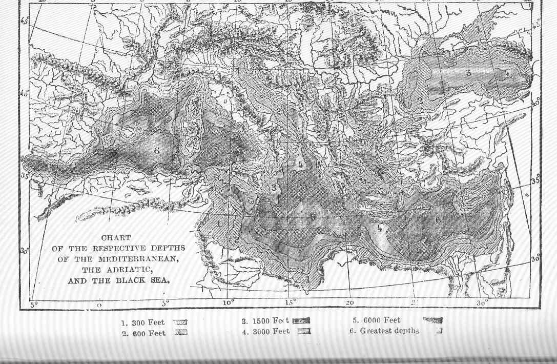
Chart of the Respective Depths of the Mediterranean, the Adriatic, and the Black Sea *Subject: Ocean, Mediterranean Sea, Adriatic Sea, Black Sea *Tag: Coasts
- Date
- 1872
- Place
- the Black Sea
- Archive
- Wikimedia Commons
- Type
- map
- Original size
- 1,087 × 710 pixels
Public domain
Reason: public domain: UWASH-FMIB.
This status rests on the map's publication history, as researched by Wikimedia Commons. Check it before commercial use.
Read from: Commons licence category: PD-UWASH-FMIB; no CC BY, CC BY-SA, GFDL or deletion tag on the file page.
Credit line
"Bottom of the Sea" (1872). Wikimedia Commons. Public domain. https://commons.wikimedia.org/wiki/File:FMIB_49947_Chart_of_the_Respective_Depths_of_the_Mediterranean,_the_Adriatic,_and_the_Black_Sea.jpegNeed maps for a whole project? Add Find Any Map to Claude and ask for this one by its id: 235714.
More like this

Ocean, Atmosphere, and Life, being the Second Series of a Descriptive History of the Life of the Globe
1873 · Wikimedia Commons

Ocean, Atmosphere, and Life, being the Second Series of a Descriptive History of the Life of the Globe
1873 · Wikimedia Commons

(Map of Black Sea and environs).
1820 · Library of Congress

PSM V09 D742 Map of the mediterranean sea
1876 · Wikimedia Commons

Ocean, Atmosphere, and Life, being the Second Series of a Descriptive History of the Life of the Globe
1873 · Prussia

Nordenskiöld 1897 Figure 13 Image 48
1897 · Library of Congress

Carte générale de la Mer Méditerranée et la Mer Noire / d'après MM. Tofiño Gauttier, A. Bérard, de Tessan, P. Monnier, W.H. Smyth, Rd Coppeland, T. Graves, etc. 1: 2 937 000 environ; L. Vuillemin del; Gravé par Leclercq
1847 · D'après MM. Tofiño Gauttier, A. Bérard, de Tessan, P. Monnier, W.H. Smyth, Rd Coppeland, T. Graves, etc. (1 - 2 937 000 environ) ; L. Vuillemin, plate 2 of 2

1748 map - An Accurate Chart of the Mediterranean and Adriatic Seas; with the Archipelago & Part of the Black Sea
1748 · Wikimedia Commons