

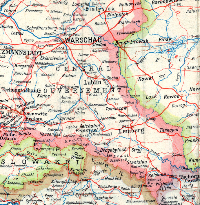
Bezirk Bialystok
A part of a map of Germany printed in July 1944 by a German unit: leichte Karten-Druckerei-Abtl. (mot) 530.
- Date
- 1944
- Place
- Belarus
- Archive
- Wikimedia Commons
- Type
- map
- Original size
- 3,101 × 2,960 pixels
Public domain
Reason: public domain: scan (PD-old-70).
This status rests on the map's publication history, as researched by Wikimedia Commons. Check it before commercial use.
Read from: Commons licence category: PD-scan (PD-old-70); no CC BY, CC BY-SA, GFDL or deletion tag on the file page.
Credit line
"Bezirk Bialystok" (1944). Wikimedia Commons. Public domain. https://commons.wikimedia.org/wiki/File:Bezirk_Bialystok.jpgNeed maps for a whole project? Add Find Any Map to Claude and ask for this one by its id: 23726.
More like this
A part of a map of Europe printed by the O.K.H. in 1943.
1944 · Wikimedia Commons

Polen 1939
1939 · Wikimedia Commons

Eisenbahn Deutschlands 1941
1941 · Wikimedia Commons

Map of General District White Ruthenia
March 31, 2024 · Wikimedia Commons

A part of a map of Europe in 1943, printed by the O.K.H.
1944 · Wikimedia Commons

The Battle of Bialystok (in Russian and German)
1941 · Wikimedia Commons

Greater Germany ". Major administrative divisions. July 1. 1944. 100 kms
1944 · Wikimedia Commons

02-Westliches Russland
1914 · Wikimedia Commons