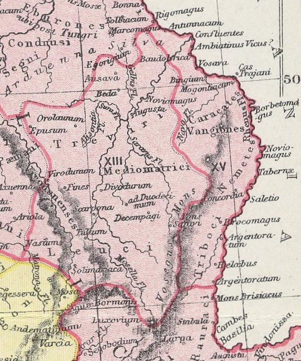

BelgicaI GermaniaI
A section of the map "GALLIA," from The Atlas of Ancient and Classical Geography showing the late Roman provinces of Germania Prima and Belgica Prima.
- Date
- 1907
- Mapmaker / publisher
- Samuel Butler
- Place
- the Ardennes
- Archive
- Wikimedia Commons
- Type
- map
- Original size
- 587 × 704 pixels
Public domain
Reason: a US government work.
This status rests on the map's publication history, as researched by Wikimedia Commons. Check it before commercial use.
Read from: Commons licence category: PD US; no CC BY, CC BY-SA, GFDL or deletion tag on the file page.
Credit line
"BelgicaI GermaniaI" (1907). Samuel Butler, via Wikimedia Commons. Public domain. https://commons.wikimedia.org/wiki/File:BelgicaI_GermaniaI.jpgNeed maps for a whole project? Add Find Any Map to Claude and ask for this one by its id: 20086.
More like this

Germania inferior (Droysens)
1886 · Wikimedia Commons

The Rhineland in the Roman era
1905 · Wikimedia Commons

Gaule et pays voisins de 768 à 771, Auguste Longnon 1907
1907 · Wikimedia Commons

An atlas of ancient geography - comprehended in sixteen maps, selected from the most approved works - to elucidate the writings of the ancient authors, both sacred and profane.
1826 · Roman Gaul, plate 13

Belgica-Germania-Gallia part of "Image:TabulaPeutingeriana.jpg"
Wikimedia Commons

F.W. Putzgers Historischer Schul-Atlas: zur alten, mittleren und neuen Geschichte: in 66 Haupt- und 63 Nebenkarten
Wikimedia Commons

Divisio Galliae secundum notitiam imperii
1668 · Roman Gaul, plate 1 of 2

Gaul in the time of Caesar
1886 · Wikimedia Commons