

Battlefield of Winchester
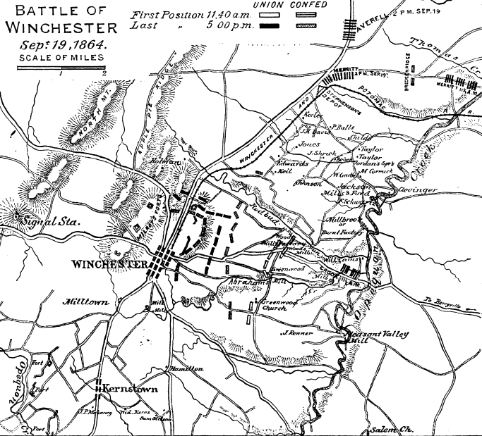
A map of the Third Battle of Winchester.
- Date
- 1887
- Mapmaker / publisher
- United States, War Department
- Archive
- Wikimedia Commons
- Type
- atlas page
- Original size
- 5,490 × 6,812 pixels
Public domainsafest
Reason: its US copyright has expired (published before 1931).
Read from: Commons licence category: PD US expired; no CC BY, CC BY-SA, GFDL or deletion tag on the file page.
Credit line
"Battlefield of Winchester" (1887). United States, War Department, via Wikimedia Commons. Public domain. https://commons.wikimedia.org/wiki/File:Battlefield_of_Winchester.jpgNeed maps for a whole project? Add Find Any Map to Claude and ask for this one by its id: 1770.
More like this

Sketch of the Battle of Winchester, September 19, 1864.
1864 · Library of Congress

3rd Winchester Final Stand View from east
1873 · Library of Congress

Second Winchester Map
1863 · Wikimedia Commons
Third Winchester 11-5 Positions
1888 · Wikimedia Commons

3rd Winchester - Crook vs Breckinridge
1873 · Library of Congress

3rd Winchester Final Stand US Gov
1873 · Wikimedia Commons

Battle fields of Fisher's Hill (22 Sept. 1864) and Cedar Creek (19 Oct. 1864), Virginia
1864 · Library of Congress

Union and Confederate campaigns in the lower Shenandoah Valley illustrated - twenty years after - at the first reunion of Sheridan's veterans on the fields and in the camps of the valley
1883 · 2 sheets