

Battle of the Somme 1916 map blank
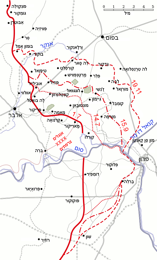
Map of the Somme battlefield, 1916, showing the frontline before the three major offensives of 1 & 14 July and 15 September as well as the final frontline at the end of the battle of 18 November. Based on a map from A Short Military History of World War I - Atlas, edited by T. Dodson Stamps and Vincent J. Esposito, 1950.
- Date
- 1916
- Mapmaker / publisher
- Battle_of_the_Somme_1916_map.png: Igiveup *derivative work: דקי ( talk )
- Archive
- Wikimedia Commons
- Type
- map
- Original size
- 600 × 990 pixels
Public domain
Reason: public domain: user.
This status rests on the map's publication history, as researched by Wikimedia Commons. Check it before commercial use.
Read from: Commons licence category: PD-user; no CC BY, CC BY-SA, GFDL or deletion tag on the file page.
Credit line
"Battle of the Somme 1916 map blank" (1916). Battle_of_the_Somme_1916_map.png: Igiveup *derivative work: דקי ( talk ), via Wikimedia Commons. Public domain. https://commons.wikimedia.org/wiki/File:Battle_of_the_Somme_1916_map_blank.pngNeed maps for a whole project? Add Find Any Map to Claude and ask for this one by its id: 22815.
More like this

Battle of the Somme 1916 map
1916 · Wikimedia Commons

Somme Front, July to October 1916
1916 · Wikimedia Commons

Map Somme front 1916
1916 · Wikimedia Commons

Somme attack fronts, 1916
1916 · Wikimedia Commons

Franco-British advances on the Somme, July-August 1916
1916 · Wikimedia Commons
Battle of the Somme 1916 map HE
July 31, 2011 · Wikimedia Commons

Franco-British advances on the north bank of the Somme to 15 July 1916
1916 · Wikimedia Commons

Somme area from Longueval to Combles, 1916
1916 · Wikimedia Commons