

Battle of Kursk, southern sector
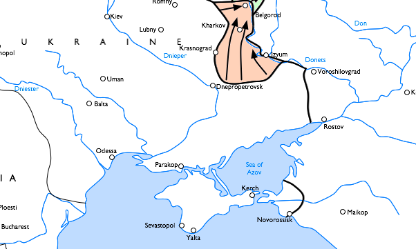
Southern sector of the Battle of Kursk. Operation Zitadelle and Operation Rumanyantcev
- Date
- February 17, 2010
- Mapmaker / publisher
- Blablaaa
- Archive
- Wikimedia Commons
- Type
- map
- Original size
- 1,023 × 645 pixels
Public domain
Reason: public domain: self.
This status rests on the map's publication history, as researched by Wikimedia Commons. Check it before commercial use.
Read from: Commons licence category: PD-self; no CC BY, CC BY-SA, GFDL or deletion tag on the file page.
Credit line
"Battle of Kursk, southern sector" (February 17, 2010). Blablaaa, via Wikimedia Commons. Public domain. https://commons.wikimedia.org/wiki/File:Battle_of_Kursk,_southern_sector.pngNeed maps for a whole project? Add Find Any Map to Claude and ask for this one by its id: 24336.
More like this

Battle of Kursk, southern sectorV2
Wikimedia Commons

Situation third battle of Kharkov
July 18, 2005 · Wikimedia Commons

Battle of Kursk (map)
Wikimedia Commons

Южен фронт ВСВ (22.06 - 10.07.1941)
February 1, 2009 · Wikimedia Commons

Third Battle of Kharkov sector
Wikimedia Commons
Cropped map showing for the Third Battle of Kharkov, based on:Image:Eastern Front 1943-02 to 1943-08.png.
November 8, 2008 · Wikimedia Commons

Operation Ring he
May 1, 2010 · Wikimedia Commons

Stalingrad Encirclement
February 14, 2008 · Wikimedia Commons