

Battle of Kolubara
This map, showing the 2nd and 3rd attacks on Serbia in 1914 by the Austrian army, was created by the Department of Military Art and Engineering, at the U.S. Military Academy (West Point). The initial version was created under the supervision of General Vincent Esposito in 1959. It is now available on the West Point web site at: The map has been cropped to remove unneeded parts of the territory.
- Date
- 2006
- Mapmaker / publisher
- Edgar Allan Poe
- Archive
- Wikimedia Commons
- Type
- map
- Original size
- 590 × 509 pixels
Public domainsafest
Reason: a US government work.
Read from: Commons licence category: PD US Government; no CC BY, CC BY-SA, GFDL or deletion tag on the file page.
Credit line
"Battle of Kolubara" (2006). Edgar Allan Poe, via Wikimedia Commons. Public domain. https://commons.wikimedia.org/wiki/File:Battle_of_Kolubara.jpgNeed maps for a whole project? Add Find Any Map to Claude and ask for this one by its id: 21958.
More like this

Battle of Cer
2006 · Wikimedia Commons

Operations at the border of Greece and Serbia during WW1
1959 · Wikimedia Commons

Operations at the border of Greece and Serbia, 1916. his map was created by the Department of Military Art and Engineering, at the U.S. Military Academy (West Point). The initial version was created u
1959 · Wikimedia Commons

This map shows the initial British attack and capture of Basra, 1914. See Battle of Basra (1914).
1914 · Wikimedia Commons

Campaign in Southwest Poland between 28 September and 1 November, 1914
1914 · Wikimedia Commons

Serbia-WW1-3
Wikimedia Commons
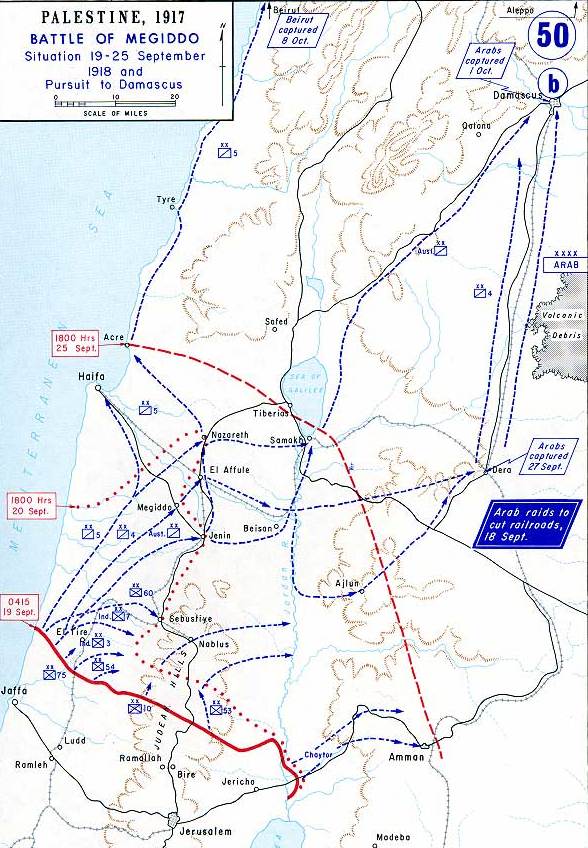
Map showing Allenby's final attack at Megiddo, September 1918.
1959 · Wikimedia Commons

This map shows Townshend's attack towards Baghdad, 1915.
1915 · Wikimedia Commons