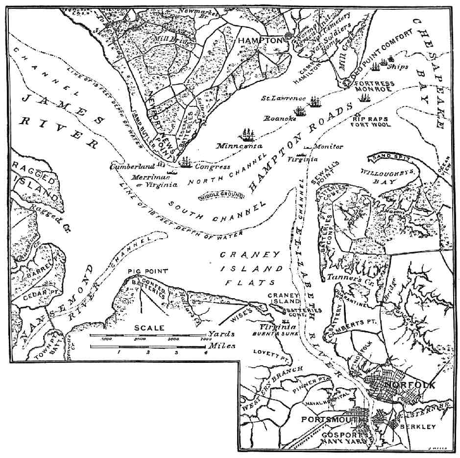

Battle of Hampton Roads Map
"Map of Hampton Roads and Vicinity." The First Fight of Iron-clads.
- Date
- 1885
- Mapmaker / publisher
- John Taylor Wood
- Place
- Virginia in the American Civil War
- Archive
- Wikimedia Commons
- Type
- map
- Original size
- 939 × 934 pixels
Public domainsafest
Reason: its US copyright has expired (published before 1931).
Read from: Commons licence category: PD US expired; no CC BY, CC BY-SA, GFDL or deletion tag on the file page; permission field: public domain.
Credit line
"Battle of Hampton Roads Map" (1885). John Taylor Wood, via Wikimedia Commons. Public domain. https://commons.wikimedia.org/wiki/File:Battle_of_Hampton_Roads_Map.pngNeed maps for a whole project? Add Find Any Map to Claude and ask for this one by its id: 582.
More like this

Copy of a map military reconnaissance Dep't Va. - (Hampton Roads and Norfolk regions, Va.)
1862 · Library of Congress

Outline map of Hampton Roads, and the vicinity of Norfolk, Va.
1861 · Library of Congress

Map of the James River Etc. from Richmond to the Ocean (Harper's Weekly, January 1862)
1862 · Wikimedia Commons

Fort Monroe and vicinity showing entrance to Chesapeake Bay, Norfolk, Portsmouth, Gosport Navy Yard etc.
1860 · Library of Congress

Chesapeake Bay, Sheet no. 1, York River, Hampton Roads, Chesapeake entrance.
1863 · Library of Congress

Chesapeake Bay. Sheet 6, from the mouth of York River to the entrance to bay.
1863 · Library of Congress

ATLAS OR SOUTHEASTERN VIRGINIA MAP
Wikimedia Commons

Johnson's map of the vicinity of Richmond, and Peninsula Campaign. Johnson 1862
1862 · Wikimedia Commons