

Battle of Guadalcanal map 22 Jan to 10 Feb 1943
Contemporary map showing the final actions of the Battle of Guadalcanal, 22 January to 10 February 1943.
- Date
- 1943
- Mapmaker / publisher
- U.S. Navy
- Archive
- Wikimedia Commons
- Type
- map
- Original size
- 1,362 × 785 pixels
Public domainsafest
Reason: a US government work (US Military).
Read from: Commons licence category: PD US Military; no CC BY, CC BY-SA, GFDL or deletion tag on the file page; permission field: "All photographs published in ALL HANDS are official Department of Defense photographs unless otherwise designated.".
Credit line
"Battle of Guadalcanal map 22 Jan to 10 Feb 1943" (1943). U.S. Navy, via Wikimedia Commons. Public domain. https://commons.wikimedia.org/wiki/File:Battle_of_Guadalcanal_map_22_Jan_to_10_Feb_1943.pngNeed maps for a whole project? Add Find Any Map to Claude and ask for this one by its id: 24487.
More like this

Operations on Guadalcanal (August-November 1942)
1942 · Wikimedia Commons

GuadMapJan-Feb1943
Wikimedia Commons

Composite information map of Guadalcanal, Florida Island and a portion of Malaita Island, December 1942
1942 · U.S. National Archives

Map of Guadalcanal and Florida islands, December 1942 (US Marine Corps)
1942 · U.S. National Archives

Solomon Islands Campaign battles map 1944
1944 · Wikimedia Commons
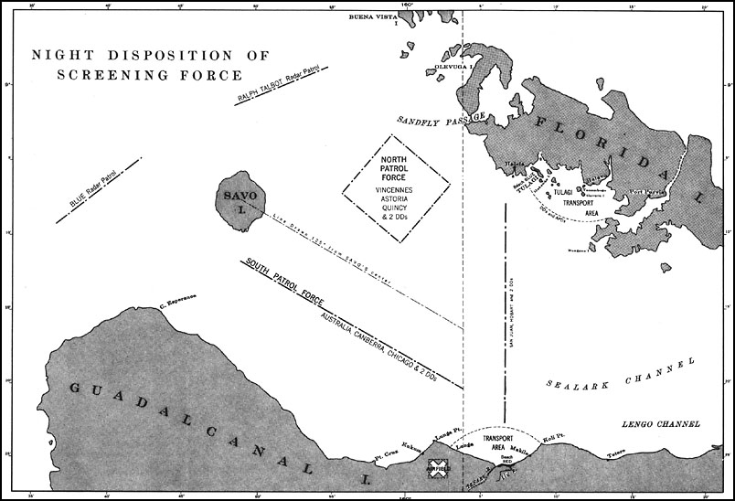
U.S. Navy map from 1943 showing disposition of Allied ships before Battle of Savo Island, 8-9 August 1942.
1943 · Wikimedia Commons

UP THE SLOT: Marines in the Central Solomons
1942 · Wikimedia Commons

Pacific War - Guadalcanal Campaign 1942 - Map
1942 · Wikimedia Commons