

Battle-field of Cedar Mountain, August 9th, 1862
"B.N. Eubank - 1949 Roanoke, Va." "J. Gordan Thomas, Culpeper, Va. furnished markers on bat-field." Map indicates Union and Confederate positions. Oriented with north toward the right. Positive blue-line print. This item is in the Map Collection of the Library of Virginia; please contact the Library's Archives Research Services department for more information. July 2002, B.N. Eubank (Aug. 1969), gift, Map Cataloging Team. Civil War Map Proj. no.: LVA00058. Conservation: Etherington Conservation Center, May 2002. Digital image available: 17.5 x 23 in. Map accession no. 2915 (1969). Previously filed as: 755.383 M6 1861-1865 1862 1958.
- Date
- 1958
- Mapmaker / publisher
- Hawley, H.; Hildebrand, J. R
- Archive
- Library of Congress (via Wikimedia Commons)
- Type
- map
- Original size
- 6,920 × 5,425 pixels
Public domain
Reason: a US government work.
This status rests on the map's publication history, as researched by Wikimedia Commons. Check it before commercial use.
Read from: Commons licence category: PD US Government; no CC BY, CC BY-SA, GFDL or deletion tag on the file page; Commons tags it as a US government work, but its record names no government maker.
Credit line
"Battle-field of Cedar Mountain, August 9th, 1862" (1958). Hawley, H.; Hildebrand, J. R. Library of Congress, Geography and Map Division, via Wikimedia Commons. Public domain. https://commons.wikimedia.org/wiki/File:Battle-field_of_Cedar_Mountain,_August_9th,_1862_LOC_lva0000058.jpgNeed maps for a whole project? Add Find Any Map to Claude and ask for this one by its id: 1338.
More like this

Battlefield of Cedar Mountain, August 9th, 1862
1862 · Library of Congress

Map(s) exhibiting part of the operations of the Army of Virginia under the command of Major General John Pope. Battlefield of Cedar Mountain, Aug. 9th 1862. The positions of the troops on the night of
1862 · Library of Congress

Vicinity of Brandy Station, Culpeper Co., Va. - showing battle-field of June 9th 1863.
1863 · Library of Congress
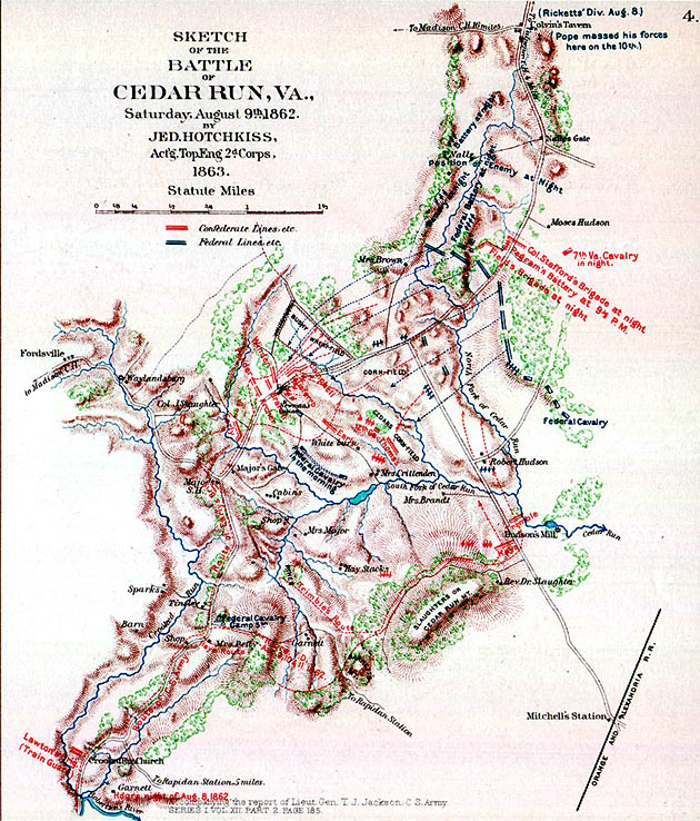
Sketch of the Battle of Cedar Run
August 9, 1862 · Wikimedia Commons

Plan of the Battle of Cedar Mountain, Virginia, August 9th, 1862.
August 9, 1862 · Library of Congress

Battle field of Bull Run, Va. July 21st 1861. Showing the positions of both armies at 4 o'clock, P.M.
1861 · Library of Congress

Map of Cedar Mountain and vicinity - and battle.
August 9, 1862 · Library of Congress

Second battle of Bull Run. Position of troops at sunset, Aug. 29, 1862.
1886 · Library of Congress