

Atlas of Massachusetts
Holyoke, Massachusetts, plate 17
Relief shown by contours and spot heights.
- Date
- 1890
- Mapmaker / publisher
- Massachusetts. Topographical Survey Commission; Geological Survey (U.S.)
- Place
- Holyoke, Massachusetts
- Archive
- Library of Congress (via Wikimedia Commons)
- Type
- atlas page
- Original size
- 4,974 × 5,977 pixels
Public domainsafest
Reason: its maker died more than 100 years ago.
Read from: Commons licence category: PD-old-100-expired; no CC BY, CC BY-SA, GFDL or deletion tag on the file page.
Credit line
"Atlas of Massachusetts" (1890). Massachusetts. Topographical Survey Commission; Geological Survey (U.S.). Library of Congress, Geography and Map Division, via Wikimedia Commons. Public domain. https://commons.wikimedia.org/wiki/File:Atlas_of_Massachusetts_LOC_2013591316-17.jpgNeed maps for a whole project? Add Find Any Map to Claude and ask for this one by its id: 8446.
More like this
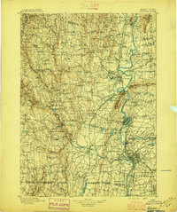
Holyoke, Massachusetts: USGS topographic map, 1:125,000 (1896–1943)
1896–1943 · 7 editions

USGS Holyoke, MA 30 minute Quadrangle SW
1938 · Wikimedia Commons

USGS Holyoke, MA 30 minute Quadrangle SE
1938 · Wikimedia Commons

Sanborn Fire Insurance Map from Holyoke, Hampden County, Massachusetts, 1889, volume 2
1889 · 30 sheets

Map of Hampden County, Massachusetts
1855 · Library of Congress

Bird's eye view of Holyoke, Mass. - 1877
1877 · Library of Congress

Richards standard atlas of Hampden County, Massachusetts - based upon, and carefully compiled from, the official plans, surveys and records of the city engineers, assessors and other municipal
1912 · Chicopee, Massachusetts, plate 4
Northampton, Massachusetts: USGS topographic map, 1:62,500 (1885–1895)
1885–1895 · 14 editions