
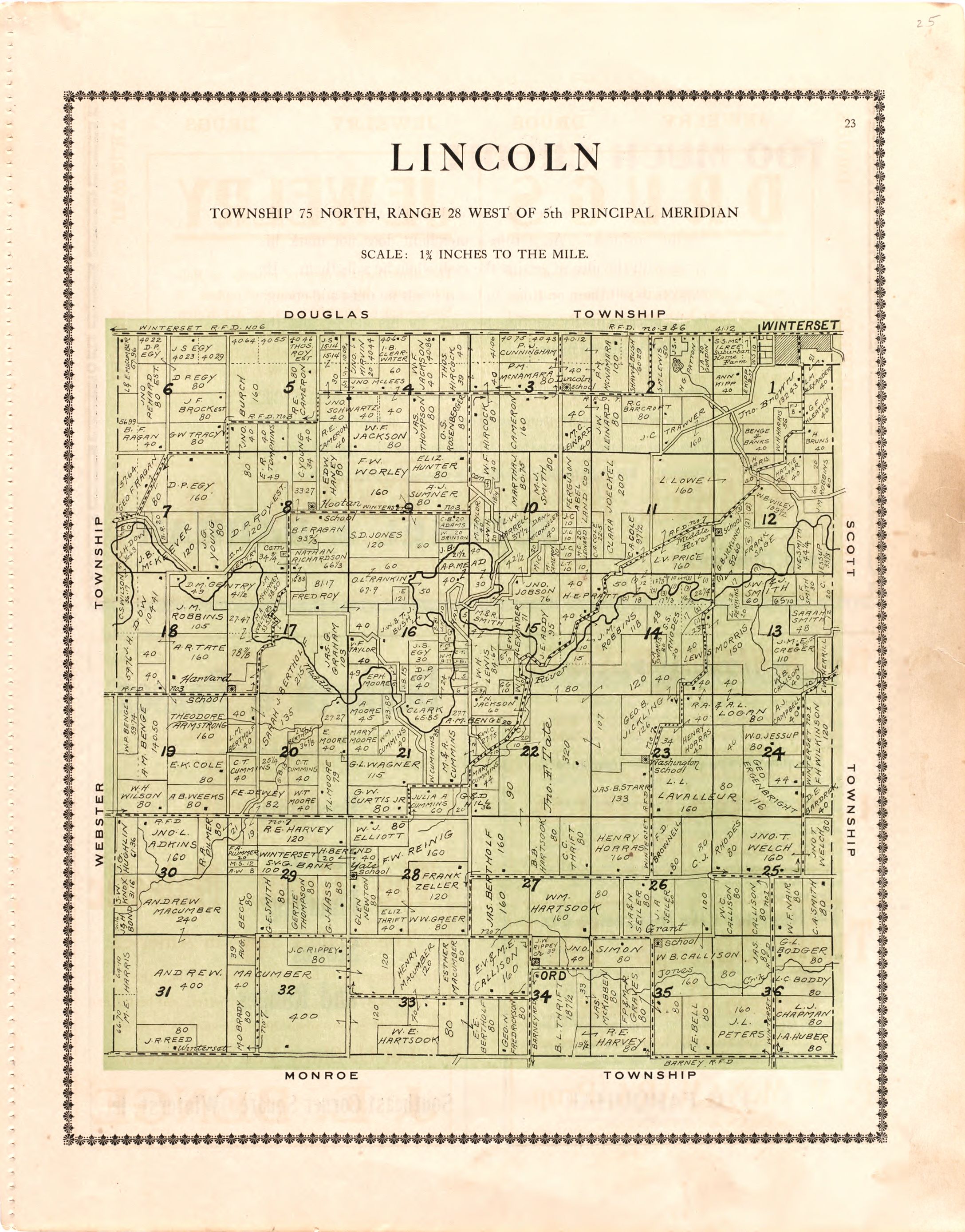
Atlas of Madison County, Iowa
Includes index and advertisements. Vendor: John Carbonell Acquisitions control no. 2006-114
- Date
- 1912
- Mapmaker / publisher
- Midland Map Company (Knoxville, Iowa)
- Archive
- Library of Congress (via Wikimedia Commons)
- Type
- atlas page
- Sheets
- 40
- Original size
- 2,194 × 2,767 pixels
Public domainsafest
Reason: its maker died more than 100 years ago.
Read from: Commons licence category: PD-old-100-expired; no CC BY, CC BY-SA, GFDL or deletion tag on the file page.
Credit line
"Atlas of Madison County, Iowa" (1912). Midland Map Company (Knoxville, Iowa). Library of Congress, Geography and Map Division, via Wikimedia Commons. Public domain. https://commons.wikimedia.org/wiki/File:Atlas_of_Madison_County,_Iowa_LOC_2007626774-1.jpgNeed maps for a whole project? Add Find Any Map to Claude and ask for this one by its id: 8443.
All 40 sheets
Each sheet links to its file at the archive; the image link is the full-size scan.

Sheet 1

Sheet 2

Sheet 3

Sheet 4

Sheet 5

Sheet 6

Sheet 7

Sheet 8

Sheet 9

Sheet 10

Sheet 11

Sheet 12

Sheet 13

Sheet 14

Sheet 15

Sheet 16

Sheet 17

Sheet 18

Sheet 19

Sheet 20

Sheet 21

Sheet 22

Sheet 23

Sheet 24

Sheet 25

Sheet 26

Sheet 27

Sheet 28

Sheet 29

Sheet 30

Sheet 31

Sheet 32

Sheet 33

Sheet 34

Sheet 35

Sheet 36

Sheet 37

Sheet 38

Sheet 39

Sheet 40




More like this

Atlas of Ida County, Iowa
1920 · 20 sheets

Atlas and plat book of Jasper County, Iowa - containing outline map of the county, plats of all the townships with owners' names, plats of all towns in the county, also state auto map, United
1914 · 40 sheets

Atlas of Ida County, Iowa - containing maps of villages, cities and townships of the county, maps of state, United States and world, farmers directory, business directory, general information.
1906 · 37 sheets

Caldwell's atlas of Madison Co., Ohio
1875 · 40 sheets

Standard atlas of Madison County, Illinois - including a plat book of the villages, cities and townships of the county, map of the state, United States and world - patrons directory, reference
1906 · 35 sheets

Atlas of Allamakee County, Iowa - containing maps of townships of the county, maps of state, United States and world, farmers directory, analysis of the system of U.S. land surveys.
1917 · 40 sheets

Atlas and plat book of Poweshiek County, Iowa - containing outline map of the county, plats of all the townships with owners' names, plats of all towns in the county, also state auto map, United
1914 · 39 sheets

An atlas of Wood County, Ohio
1912 · 40 sheets