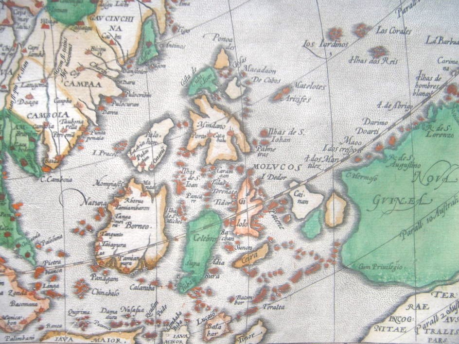

Asia (1570) southeast
"Cambaia," a miniature map by *Abraham Ortelius*, published in 1583, with modern hand coloring; CLICK ON THE MAP FOR A VERY LARGE SCAN A version of the map from c.1616: *the whole map*: *northwest*; *northeast*; *southwest*; *southeast* Other Ortelius miniature maps, from various atlases, many with modern hand coloring
- Date
- 1583–1616
- Mapmaker / publisher
- Abraham Ortelius
- Place
- Southeast Asia
- Archive
- Wikimedia Commons
- Type
- map
- Original size
- 944 × 708 pixels
Public domain
Reason: its maker died long enough ago that the copyright has expired.
This status rests on the map's publication history, as researched by Wikimedia Commons. Check it before commercial use.
Read from: Commons licence category: PD Old; no CC BY, CC BY-SA, GFDL or deletion tag on the file page.
Credit line
"Asia (1570) southeast" (1583–1616). Abraham Ortelius, via Wikimedia Commons. Public domain. https://commons.wikimedia.org/wiki/File:Asia_(1570)_southeast_(cropped).jpgNeed maps for a whole project? Add Find Any Map to Claude and ask for this one by its id: 240397.
More like this

Asia (1588) a closer view
1583–1616 · Wikimedia Commons

From a full-sized map of Asia by Ortelius, 1595 southeast
1595 · Wikimedia Commons

India and Southeast Asia
1583–1616 · 2 sheets

From a full-sized map of Asia by Ortelius, 1595 north east
1595 · Wikimedia Commons

From a full-sized map of Asia by Ortelius, 1595 northwest
1595 · Wikimedia Commons

Cambaia, a miniature map by Abraham Ortelius, published in 1583, with modern hand coloring
1583 · Wikimedia Commons

From a full-sized map of Asia by Ortelius, 1595 southwest
1595 · Wikimedia Commons

From a full-sized map of Asia by Ortelius, 1595 the whole map
1595 · Wikimedia Commons