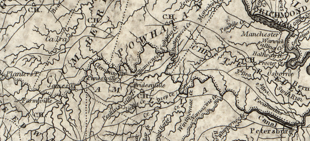

Appomattox River Canal Navigation System 1814 Map
cropped from a map of Eastern Virginia by Samuel Lewis
- Date
- c. 1814
- Mapmaker / publisher
- Lewis, Samuel Hooker, William
- Place
- the Appomattox River
- Archive
- Library of Congress (via Wikimedia Commons)
- Type
- map
- Original size
- 1,033 × 471 pixels
Public domain
Reason: a US government work.
This status rests on the map's publication history, as researched by Wikimedia Commons. Check it before commercial use.
Read from: Commons licence category: PD US; no CC BY, CC BY-SA, GFDL or deletion tag on the file page.
Credit line
"Appomattox River Canal Navigation System 1814 Map" (c. 1814). Lewis, Samuel Hooker, William. Library of Congress, Geography and Map Division, via Wikimedia Commons. Public domain. https://commons.wikimedia.org/wiki/File:Appomattox_River_Canal_Navigation_System_1814_Map.jpgNeed maps for a whole project? Add Find Any Map to Claude and ask for this one by its id: 7926.
More like this

1814 Map of Eastern Virginia by Samuel Lewis
c. 1814 · Library of Congress

A new map of Virginia with Maryland, Delaware & v.
1814 · Library of Congress

Virginia Central Map 1852 cropped
1852 · Library of Congress

Amelia County
1864 · Library of Congress

A map of the internal improvements of Virginia; prepared by C. Crozet, late principal engineer of Va. under a resolution of the General Assembly adopted March 15th 1848.
1848 · Library of Congress

Railroads in Virginia and part of North Carolina, drawn and engraved for Doggett's Railroad Guide & Gazetteer.
1848 · Library of Congress

Map of the Springfield & Deep Run estates on the Coal Lands of the N. York & Richmond Coal Co, in Henrico Co. Virginia, their relative position to the city of Richmond with rail road connections etc.
1856 · Library of Congress

Map of eastern and central Virginia.
1864 · Library of Congress