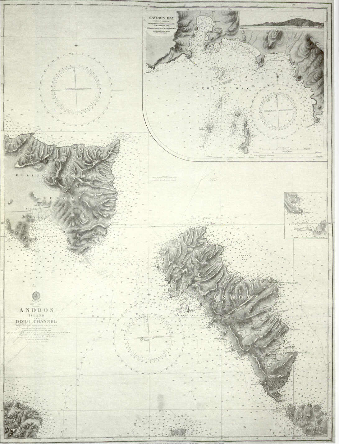

Andros Island-1844
Admiralty chart of Andros Island and Cape Doro strait (today Kafireus Strait), Greece. Includes a large scale chart of Gavrion Bay (1844).
- Date
- 1844
- Mapmaker / publisher
- Office of Hydrographer to the Admiralty, headed by Admiral Beaufort
- Place
- the Aegean Sea
- Archive
- Wikimedia Commons
- Type
- chart
- Original size
- 1,091 × 1,431 pixels
Public domain
Reason: public domain: scan (PD-UKGov).
This status rests on the map's publication history, as researched by Wikimedia Commons. Check it before commercial use.
Read from: Commons licence category: PD-scan (PD-UKGov); no CC BY, CC BY-SA, GFDL or deletion tag on the file page.
Credit line
"Andros Island-1844" (1844). Office of Hydrographer to the Admiralty, headed by Admiral Beaufort, via Wikimedia Commons. Public domain. https://commons.wikimedia.org/wiki/File:Andros_Island-1844.jpgNeed maps for a whole project? Add Find Any Map to Claude and ask for this one by its id: 242077.
More like this

1854 nautical chart of the Aeagean Sea
1854 · Wikimedia Commons

1854 nautical chart - Carte de la partie septentrionale de l'Archipel
1854 · Wikimedia Commons

Nautical chart of the Aegean Sea, Sea of Marmara and the Straits.
1818 · Wikimedia Commons

Admiralty Chart No 884 Nautical chart of Artaki Bay, Sea of Marmara, Published 1881
1881 · Wikimedia Commons

Carte de la partie septentrionale de l'Archipel
1889 · Wikimedia Commons

Map of the northern part of the Greek archipelago
c. 1665 · Wikimedia Commons

Map of Artaki Bay, Sea of Marmara
1881 · Wikimedia Commons

Atlas nautique de la Mer Méditerranée
1662 · Plate 4 of 9