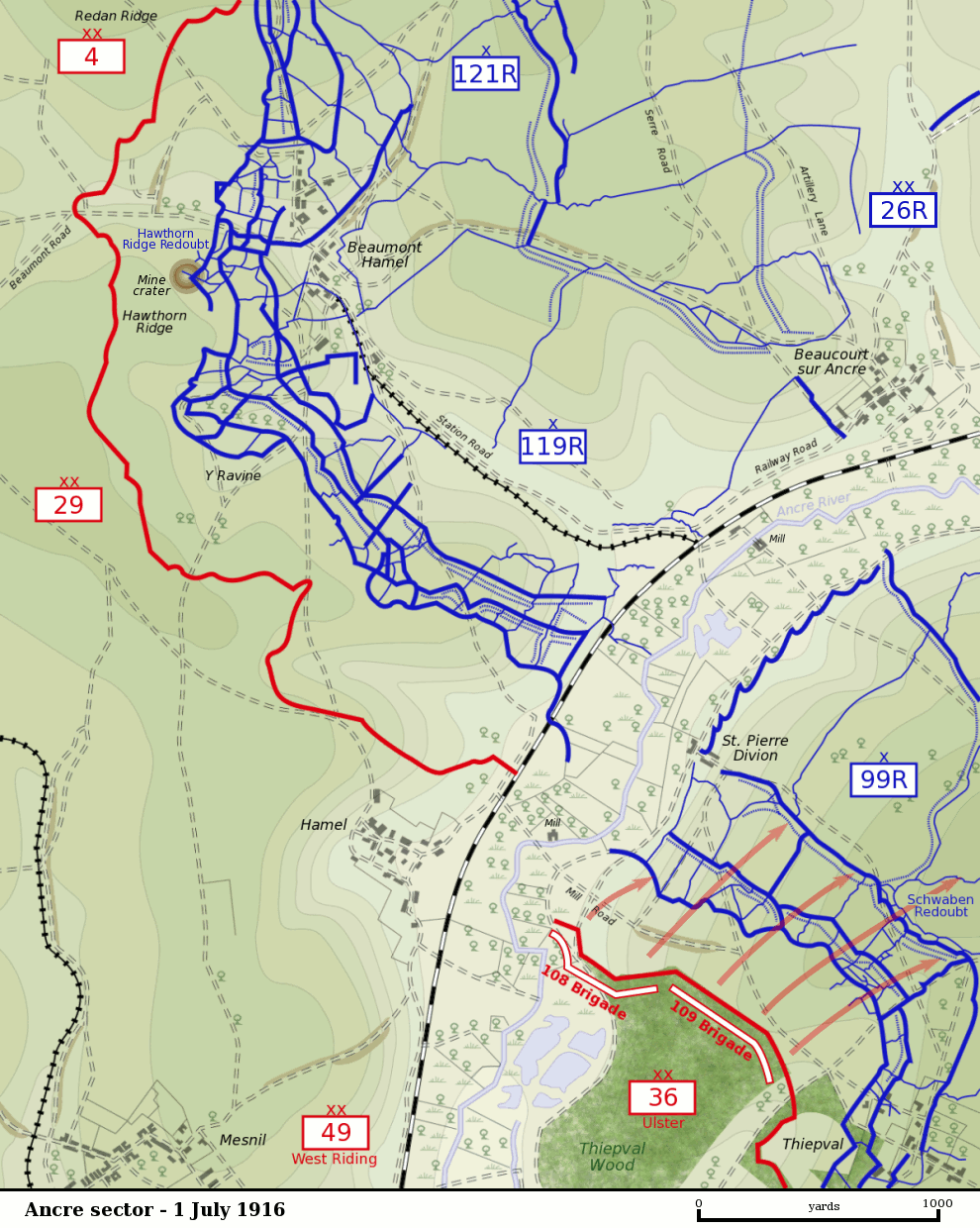

Ancre sector 1 July 1916
Map of the Ancre River sector of the Somme battlefield on the first day of the Battle of the Somme, 1 July 1916. British front line is shown in red. German trenches are shown in blue. German barbed wire is shown as dotted blue lines. The British divisions attacking on this sector were the British 29th Division at Beaumont Hamel and the 36th (Ulster) Division between the Ancre and Thiepval. The British 4th Division was attacking to the north towards Serre. The British 49th (West Riding) Division was in reserve. The sector was defended by the German 26th Reserve Division which had three regiments - 99th Reserve, 119th Reserve and 121st Reserve - in the front-line. The progress of the British 109th Brigade which captured the Schwaben Redoubt is shown.
- Date
- November 21, 2004
- Mapmaker / publisher
- Gsl
- Archive
- Wikimedia Commons
- Type
- map
- Original size
- 990 × 1,240 pixels
Public domain
Reason: public domain: user.
This status rests on the map's publication history, as researched by Wikimedia Commons. Check it before commercial use.
Read from: Commons licence category: PD-user; no CC BY, CC BY-SA, GFDL or deletion tag on the file page.
Credit line
"Ancre sector 1 July 1916" (November 21, 2004). Gsl, via Wikimedia Commons. Public domain. https://commons.wikimedia.org/wiki/File:Ancre_sector_1_July_1916.pngNeed maps for a whole project? Add Find Any Map to Claude and ask for this one by its id: 22854.
More like this

La Boisselle sector 1 July 1916
2004 · Wikimedia Commons

Attack on Schwaben Redoubt 1 July 1916 map
November 21, 2004 · Wikimedia Commons

Ancre front, 1916
1916 · Wikimedia Commons
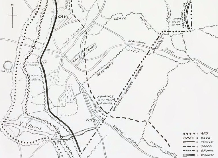
51st (Highland) Division objectives at Beaumont Hamel, November 1916
1916 · Wikimedia Commons

Map of German defensive fortifications from Thiepval to Courcelette, July 1916
1916 · Wikimedia Commons

British plan Somme 1 July 1916
1916 · Wikimedia Commons

Sausage Valley Somme 1 July 1916 map
2004 · Wikimedia Commons

Somme attack fronts, 1916
1916 · Wikimedia Commons