

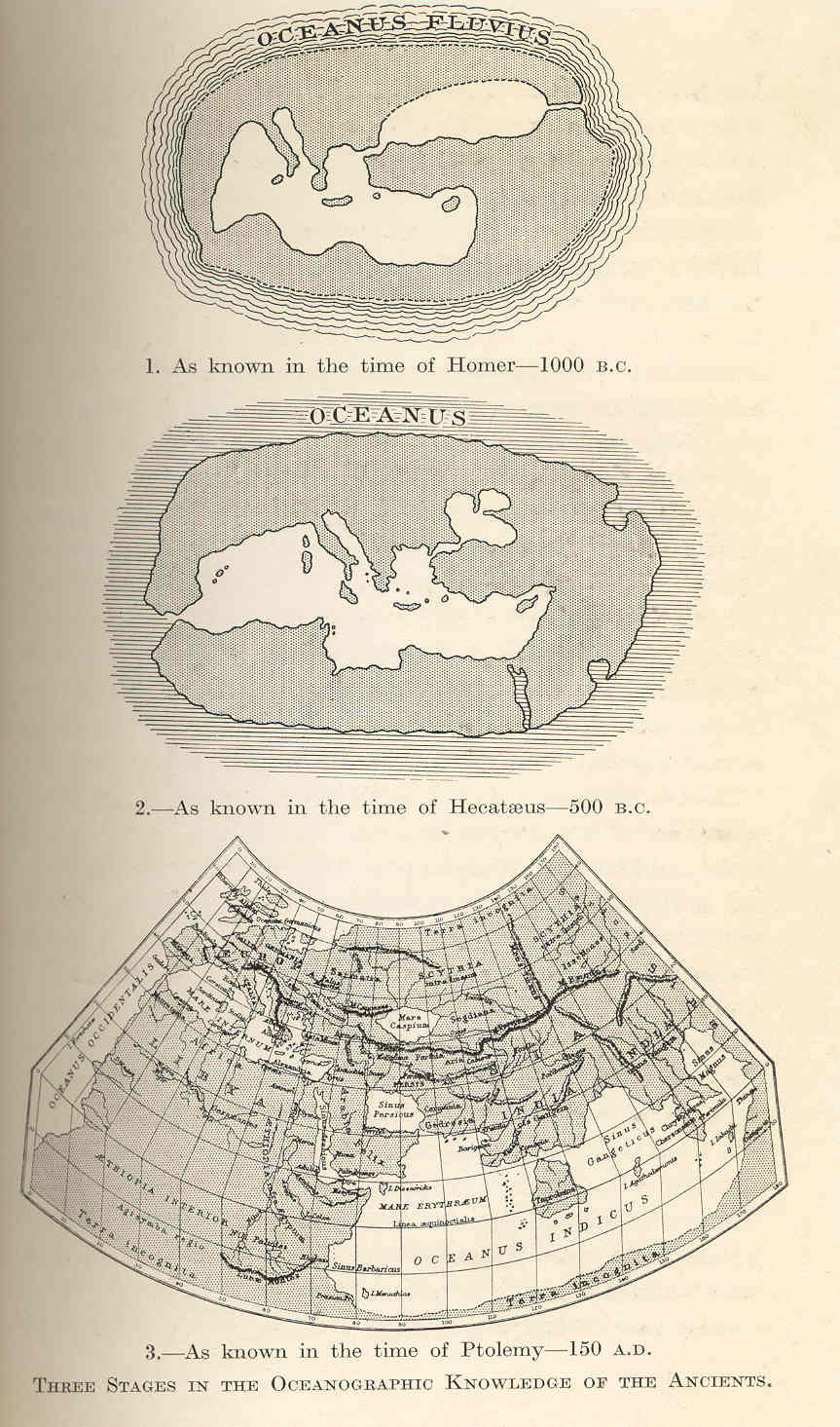
Ancient greek maps 3 stages
Three Stages in the Oceanographic Knowledge of the Ancients 1. As Known in the time of Homer--1000 B.C. 2.As Known in the time of Hecataeus--500 B.C. 3.As known in the time of Ptolemy--150 A.D. 1923
- Date
- 1923
- Mapmaker / publisher
- Herdman, William A
- Archive
- Wikimedia Commons
- Type
- map
- Original size
- 799 × 1,360 pixels
Public domain
Reason: a US government work.
This status rests on the map's publication history, as researched by Wikimedia Commons. Check it before commercial use.
Read from: Commons licence category: PD US; no CC BY, CC BY-SA, GFDL or deletion tag on the file page.
Credit line
"Ancient greek maps 3 stages" (1923). Herdman, William A, via Wikimedia Commons. Public domain. https://commons.wikimedia.org/wiki/File:Ancient_greek_maps_3_stages.jpgNeed maps for a whole project? Add Find Any Map to Claude and ask for this one by its id: 145178.
More like this
Founders of Oceanography and Their Work: an Introduction to the Science of the Sea
1923 · Wikimedia Commons

Les Principaux Systemes Geographiques des Anciens
1877 · Wikimedia Commons

Ptolemy's Map of the World
1912 · 2 sheets

Map of three ancient world depictions, 1683
1683 · Wikimedia Commons

An illustration from the Encyclopaedia Biblica, a 1903 publication which is now in the public domain. Map 1 for article "Geography". Map of the world, by Strabo
1903 · Wikimedia Commons

PSM V16 D507 Map from the time of hipparcus 100 bc
1879–1880 · Wikimedia Commons

Nordenskiöld 1897 Figure 01 Image 016
1897 · Library of Congress

The World according to Herodotus, H. G. Wells' Outline of History, page 161
1923 · Wikimedia Commons