

All About San Francisco
This pictorial map, “All About San Francisco” is beautifully illustrated in the popular 1940’s art-deco style. This black, white and red street map and birds-eye view of San Francisco also features a detailed map of the Golden Gate Park and Panhandle on the verso, as well as a detailed listing of streets and “Places to Go and Things to See.” The map includes a number of interesting landmarks, such as the “war housing projects,” noted by dotted orange lines. Published by James Ladd Delkin.
- Date
- 1943
- Place
- San Francisco
- Archive
- Wikimedia Commons
- Type
- map
- Original size
- 5,000 × 5,374 pixels
Public domainsafest
Reason: published in the US without a copyright notice (before 1978).
Read from: Commons licence category: PD US no notice; no CC BY, CC BY-SA, GFDL or deletion tag on the file page.
Credit line
"All About San Francisco" (1943). Wikimedia Commons. Public domain. https://commons.wikimedia.org/wiki/File:1943_Delkin_Pictorial_Map_of_San_Francisco,_Califoria_-_Geographicus_-_SanFrancisco-delkin-1943.jpgNeed maps for a whole project? Add Find Any Map to Claude and ask for this one by its id: 303805.
More like this

Graphic chart of the city and county of San Francisco
1875 · Library of Congress

Pictorial Map of Edinburgh and Leith.
1935 · 1935 Reid Pictorial Map of Edinburgh and Leith

Jerusalem in Third Dimension
1947 · Wikimedia Commons

Birdseye view of San Francisco and surrounding country.
1876 · Library of Congress

San Jose, California.
1901 · Library of Congress

Greater Los Angeles - the wonder city of America
1932 · Library of Congress

The city of San Francisco. Birds eye view from the bay looking south-west.
1878 · Library of Congress
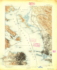
San Francisco, California: USGS topographic map, 1:62,500 (1895–1915)
1895–1915 · 14 editions