

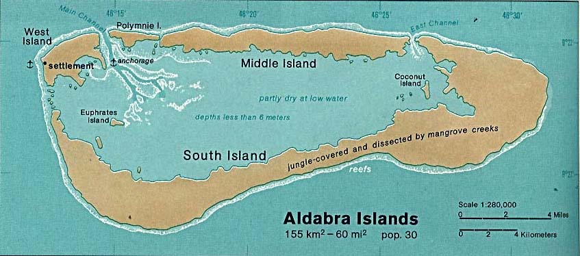
Aldabra Islands
Map of the Aldabra Islands
- Date
- 1901
- Mapmaker / publisher
- C. Keller
- Place
- Africa
- Archive
- Wikimedia Commons
- Type
- map
- Original size
- 1,154 × 644 pixels
Public domainsafest
Reason: its US copyright has expired (published before 1931).
Read from: Commons licence category: PD US expired; no CC BY, CC BY-SA, GFDL or deletion tag on the file page.
Credit line
"Aldabra Islands" (1901). C. Keller, via Wikimedia Commons. Public domain. https://commons.wikimedia.org/wiki/File:Aldabra_Islands.jpgNeed maps for a whole project? Add Find Any Map to Claude and ask for this one by its id: 238340.
More like this

The Seychelles
1901 · Wikimedia Commons
Aldabra islands seychelles 76
1976 · Wikimedia Commons

Wallace Island Life p425
1895 · Africa, plate 425

Plan of the Islands Aldabra from the Observations made in the boat Charles & Tartan Elizabeth 1744 / Hydrographical Office; WH
1784 · Wikimedia Commons

Andrees allgemeiner Handatlas: in 147 Haupt- und 163 Nebenkarten auf 223 Kartenseiten nebst vollständigem alphabetischem Namenverzeichnis
Wikimedia Commons

AFR V4 D576 Seychelles
June 12, 1893 · Wikimedia Commons

Map of Bermuda from Lefroy's Memorials v2 1879
1879 · Wikimedia Commons

FORBES(1910) 05 Map of Sierra Leone
1910 · Wikimedia Commons