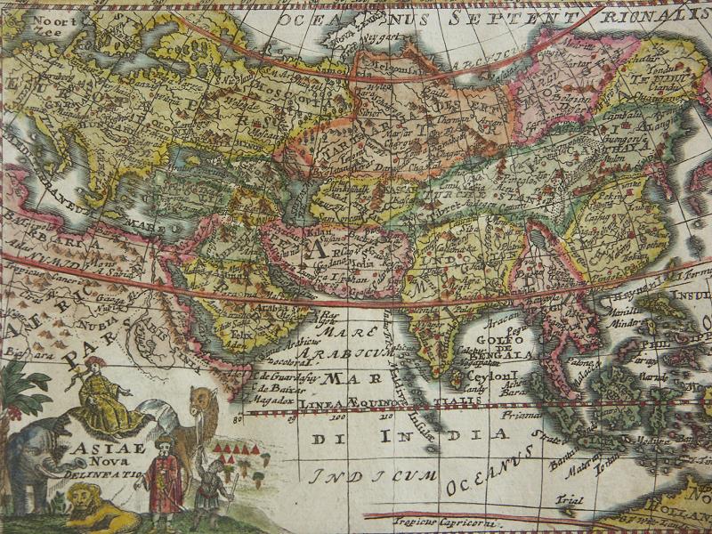

Africa Asia Persia India China Map in 1735 by Veith
Asia, by M. Veith, from "Der seinen zu erziehen habenden jungen Cavalier in der Profan- und Kirchen-Historie." by Ludovico de Launay, Augsburg, c.1735 Published in 18th century License qualifies under PD-Art Archived by Columbia University
- Date
- 1735
- Mapmaker / publisher
- M. Veith
- Place
- India
- Archive
- Wikimedia Commons
- Type
- map
- Original size
- 800 × 600 pixels
Public domain
Reason: a US government work.
This status rests on the map's publication history, as researched by Wikimedia Commons. Check it before commercial use.
Read from: Commons licence category: PD US; no CC BY, CC BY-SA, GFDL or deletion tag on the file page.
Credit line
"Africa Asia Persia India China Map in 1735 by Veith" (1735). M. Veith, via Wikimedia Commons. Public domain. https://commons.wikimedia.org/wiki/File:Africa_Asia_Persia_India_China_Map_in_1735_by_Veith.jpgNeed maps for a whole project? Add Find Any Map to Claude and ask for this one by its id: 240839.
More like this

South Asia, India Map in 1730 by Matthaeus Seutter
1730 · Wikimedia Commons

Map of India by Alexis-Hubert Jaillot France in 1674
1674 · Wikimedia Commons

A detailed 1744 Homann Heirs map of the Asia, including the East Indies. Extends from Europe and Africa eastward through Arabia and India to include the East Indies, Siberia, the Philippines, and a pa
1744 · Wikimedia Commons

17th century Jollain Map of India, South Asia, Southeast Asia
1653 · Wikimedia Commons

A very scarce, c. 1706, map of Asia issued by Daniel de La Feuille. Extends from the Mediterranean to Alaska and as far south as Java. Depicts the Mogol Empire in India, the kingdoms of Siam and Choch
1706 · Wikimedia Commons

Inde South Asia Map in 1721 by Nicholas de Fer and J. Robbe
1721 · Wikimedia Commons

ASIA Secundum legitimas Projectionis Stereographicae regulas et juxta recentissimas observationes aeque et relationes explosis aliorum fabulosis designationibus et narrationibus adhibitis quoque veterum monumentis et recentiorum itinerariis descripta et in partes suas methodicas IX divisa a I. MATTH
1744 · Wikimedia Commons

A hand-colored map of Asia. It is a later edition of Homann's 1712 map of Asia. The Caspian Sea and the lands north of Japan have been re-engraved.
1730 · Wikimedia Commons