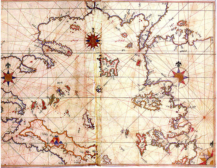

Aegean Sea by Piri Reis
Aegean Sea in the Kitab-ı Bahriye (Book of Navigation) of Piri Reis Map of Rhodes and Marmaris made by Turkish Admiral Piri Reis appearing in his maritime guide-book of 1528, Kitab-i Bahriye. Original is in Nuruosmaniye Library in Istanbul,.
- Date
- October 29, 2006
- Place
- the Aegean Sea
- Archive
- Wikimedia Commons
- Type
- map
- Original size
- 724 × 562 pixels
Public domain
Reason: public domain: Ottoman.
This status rests on the map's publication history, as researched by Wikimedia Commons. Check it before commercial use.
Read from: Commons licence category: PD-Ottoman; no CC BY, CC BY-SA, GFDL or deletion tag on the file page.
Credit line
"Aegean Sea by Piri Reis" (October 29, 2006). Wikimedia Commons. Public domain. https://commons.wikimedia.org/wiki/File:Aegean_Sea_by_Piri_Reis.jpgNeed maps for a whole project? Add Find Any Map to Claude and ask for this one by its id: 239903.
More like this

Cyprus by Piri Reis
October 29, 2006 · Wikimedia Commons

Map of the Upper Aegean Sea with the Islands of Imbros and Bozca
Piri Reis

Map of the Islands of Semendrek and Imroz in the Aegean Sea
Piri Reis

Map of the Northeastern Tip of Rhodes Island Facing the Anatolian Coast with the Island of Syme
Piri Reis

Piri Reis map of Europe and the Mediterranean Sea
1525 · Wikimedia Commons

Lesbos and Ayvalik by Piri Reis
Wikimedia Commons

Stevenson 1911 atlasofportolanc00magg 0018 VI Aegean Sea
December 31, 1911 · Wikimedia Commons

Map of the Island of Leros
Piri Reis