

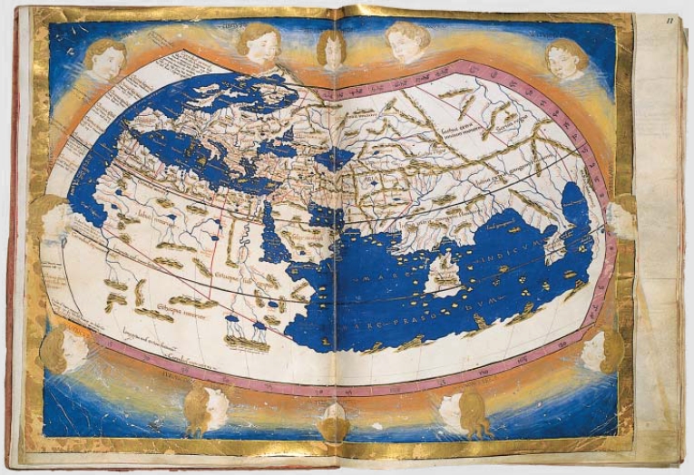
A mid-15th century Florentine map of the world based on Jacobus Angelus's 1406 Latin translation of Maximus Planudes's late-13th century rediscovered Greek manuscripts of Ptolemy's 2nd-century Geograp
- Date
- 1450–1475
- Mapmaker / publisher
- Credited to Francesco di Antonio del Chierico
- Place
- the Persian Gulf
- Archive
- Wikimedia Commons
- Type
- map
- Original size
- 1,500 × 1,026 pixels
Public domainsafest
Reason: its maker died more than 100 years ago.
Read from: Commons licence category: PD-old-100-expired; no CC BY, CC BY-SA, GFDL or deletion tag on the file page.
Credit line
"A mid-15th century Florentine map of the world based on Jacobus Angelus's 1406 Latin translation of Maximus Planudes's late-13th century rediscovered Greek manuscripts of Ptolemy's 2nd-century Geograp" (1450–1475). Credited to Francesco di Antonio del Chierico, via Wikimedia Commons. Public domain. https://commons.wikimedia.org/wiki/File:PtolemyWorldMap.jpgNeed maps for a whole project? Add Find Any Map to Claude and ask for this one by its id: 21358.
More like this
Cosmographia Claudii Ptolomaei
1467 · Wikimedia Commons

The world map from a 1474 Florentine Latin edition of Maximus Planudes's late-13th century rediscovered Greek manuscripts of Ptolemy's 2nd-century Geography.
1474 · Wikimedia Commons

Greek world map after Ptolemy's 1st projection
Wikimedia Commons

A collection of maps, in Greek, after Ptolemy's Geographia
1420 · 2 sheets

Ptolemaic world map - Totivs partis habitatae cognitae qve terrae descriptio
1480 · Wikimedia Commons

The Yale world map of "Henricus Martellus Germanus" (Heinrich Hammer), probably from Florence 1490-92. It is the most detailed "Dragon Tail" map by Martellus. It is the only one with a coordinate grid
1490 · Wikimedia Commons

Anonymous map of the world, 1450-1470
1450 · Wikimedia Commons

A map of the world based on a description by Claudius Ptolemaeus of Alexandria
1477–2005 · Wikimedia Commons