

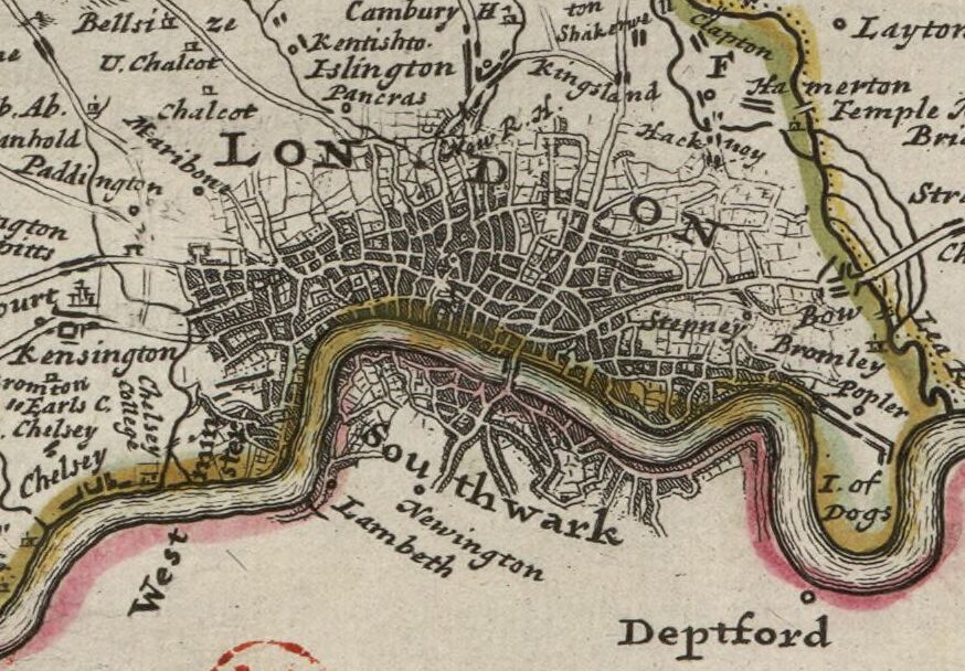
A Mapp of the County of Midlesex
Map of Middlesex, including London and the Thames; sixth state of the plate; illustration to 'England exactly described' (1720 ed.) 1667 Etching
- Date
- 1667
- Place
- Middlesex
- Archive
- Wikimedia Commons
- Type
- map
- Original size
- 1,855 × 1,272 pixels
Public domainsafest
Reason: its maker died more than 100 years ago.
Read from: Commons licence category: PD-old-100-expired; no CC BY, CC BY-SA, GFDL or deletion tag on the file page; permission field: © The Trustees of the British Museum, released as CC BY-NC-SA 4.0.
Credit line
"A Mapp of the County of Midlesex" (1667). Wikimedia Commons. Public domain. https://commons.wikimedia.org/wiki/File:A_Mapp_of_the_County_of_Midlesex_(BM_1927,1126.1.17.34).jpgNeed maps for a whole project? Add Find Any Map to Claude and ask for this one by its id: 244222.
More like this

Middlesex: County map by Robert Morden, first published in 'Britannia' in 1695. This copy from the 1722 edition.
1695 · Wikimedia Commons

An actuall survey of Midlesex
c. 1674 · Wikimedia Commons

A Mapp of the County of Middlesex with its Hundreds
1667 · Wikimedia Commons

Middlesex. State 6.
Wikimedia Commons

Middle-sexia - Atlas Maior, vol 5, map 19 - Joan Blaeu, 1667 - BL 114.h(star).5.
1667 · Wikimedia Commons
Midlesex by H. Moll Geographer
1724 · Wikimedia Commons

A Map of the County of Middlesex / T. Badeslade delin.; W. H. Toms sculpt.
1742 · Wikimedia Commons

Midlesex by H. Moll Geographer
1724 · Wikimedia Commons