

A left front view of a NATO E-3A airborne warning and control system aircraft, assigned to Gielenkerchen Airbase, West Germany, taking off during Air Fete '88, a NATO aircraft display hosted by the 513th Airborne Command and Control Wing
The original finding aid described this photograph as: Subject Operation/Series: AIR FETE '88 Base: Raf Mildenhall Country: Great Britain / England (GBR) Scene Camera Operator: Unknown Release Status: Released to Public
- Date
- May 28, 1988
- Archive
- U.S. National Archives (via Wikimedia Commons)
- Type
- map
- Original size
- 2,830 × 1,850 pixels
Public domainsafest
Reason: a US government work (US Military).
Read from: Commons licence category: PD US Military; no CC BY, CC BY-SA, GFDL or deletion tag on the file page.
Credit line
"A left front view of a NATO E-3A airborne warning and control system aircraft, assigned to Gielenkerchen Airbase, West Germany, taking off during Air Fete '88, a NATO aircraft display hosted by the 513th Airborne Command and Control Wing" (May 28, 1988). U.S. National Archives, via Wikimedia Commons. Public domain. https://commons.wikimedia.org/wiki/File:A_left_front_view_of_a_NATO_E-3A_airborne_warning_and_control_system_aircraft,_assigned_to_Gielenkerchen_Airbase,_West_Germany,_taking_off_during_Air_Fete_%2788,_a_NATO_aircraft_displ_-_DPLA_-_3b4acf62336d6cfb6c68a44a7557de72.jpegNeed maps for a whole project? Add Find Any Map to Claude and ask for this one by its id: 104236.
More like this

The E-3 Sentry is a modified Boeing 707/320 commercial airframe with a rotating radar dome. The dome is 30 feet in diameter, 6 feet thick and is held 11 feet above the fuselage by two struts. It conta
October 13, 2005 · Wikimedia Commons

E-3 Sentry above the high Arctic
March 9, 2020 · Wikimedia Commons

A KC-10 refueling aircraft flying in Antarctica
1985 · Wikimedia Commons

Sky writer painted the sky at Arctic Thunder Open House, Joint Base Elmendorf-Richardson, Alaska, July 1, 2018
2018 · Wikimedia Commons

Viligant Shield 16 151022-Z-BT533-046
October 22, 2015 · Wikimedia Commons

A Pilatus PC-9 aircraft simulates an airborne chemical attack against the Royal Danish Navy ocean patrol vessel HDMS Thetis (F357) in the Baltic Sea June 13, 2013, as part of Baltic Operations (BALTOPS) 2013 130613-N-ZZ999-034
June 13, 2013 · Wikimedia Commons
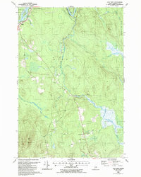
East Winn, Maine: USGS topographic map, 1:24,000 (1988)
1988 · USGS Historical Topographic Map Collection
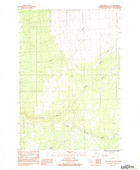
Anchorage D-8 SE, Alaska: USGS topographic map, 1:25,000 (1983)
1983 · USGS Historical Topographic Map Collection