

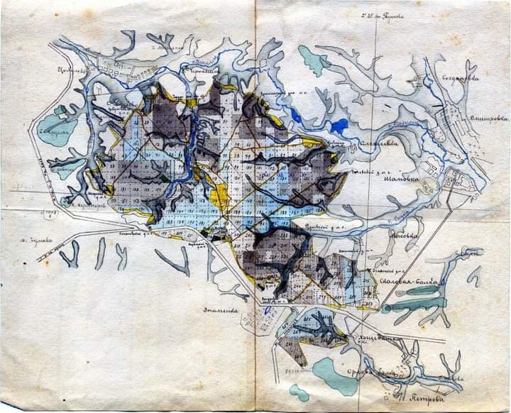
Кустолові хутори, містечко Білики
- Date
- 19th century
- Mapmaker / publisher
- Ejensyd
- Place
- Ukraine
- Archive
- Wikimedia Commons
- Type
- map
- Original size
- 867 × 762 pixels
Public domain
Reason: its maker died long enough ago that the copyright has expired.
This status rests on the map's publication history, as researched by Wikimedia Commons. Check it before commercial use.
Read from: Commons licence category: PD Old; no CC BY, CC BY-SA, GFDL or deletion tag on the file page.
Credit line
"Кустолові хутори, містечко Білики" (19th century). Ejensyd, via Wikimedia Commons. Public domain. https://commons.wikimedia.org/wiki/File:%D0%9A%D1%83%D1%81%D1%82%D0%BE%D0%BB%D0%BE%D0%B2%D1%96_%D1%85%D1%83%D1%82%D0%BE%D1%80%D0%B8,_%D0%BC%D1%96%D1%81%D1%82%D0%B5%D1%87%D0%BA%D0%BE_%D0%91%D1%96%D0%BB%D0%B8%D0%BA%D0%B8.jpgNeed maps for a whole project? Add Find Any Map to Claude and ask for this one by its id: 251867.
More like this

Вечірній Кут (карта сер. ХІХ ст.)
Wikimedia Commons

Shipilovka map 1890
1860–1890 · Wikimedia Commons
Знам'янка, карта кінця 19 століття
January 24, 1890 · Wikimedia Commons

Poltavska gubernia povity stany 1859
1862 · Wikimedia Commons

Старая Ёлча і наваколлі на мапе Ф. Шубэрта. Сярэдзіна XIX ст
Wikimedia Commons

Volhynian Gov - part Wysock
1887 · Wikimedia Commons

Крупецкая волость
December 31, 1785 · Wikimedia Commons

Горошки у 1846-1863
January 2, 1846 · Wikimedia Commons