

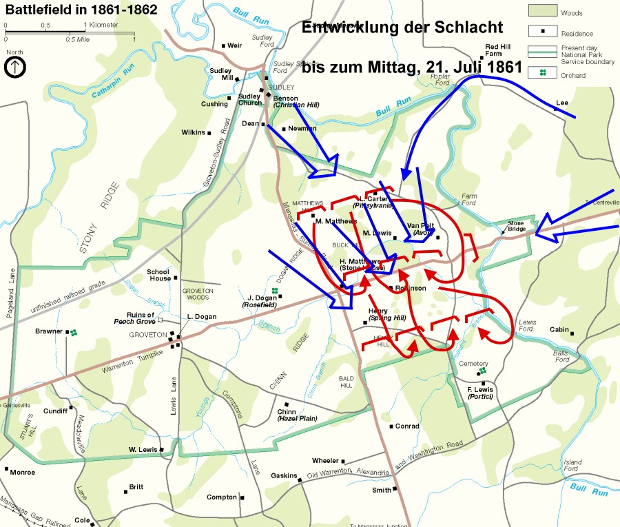
1st Manassas vormittags
Operations at 1st Manassas before noon, July 21, 1861
- Date
- 1861
- Mapmaker / publisher
- Drawing: Edmund Ferman
- Archive
- Wikimedia Commons
- Type
- map
- Original size
- 900 × 765 pixels
Public domainsafest
Reason: a US government work (NPS).
Read from: Commons licence category: PD US NPS; no CC BY, CC BY-SA, GFDL or deletion tag on the file page.
Credit line
"1st Manassas vormittags" (1861). Drawing: Edmund Ferman, via Wikimedia Commons. Public domain. https://commons.wikimedia.org/wiki/File:1st_Manassas_vormittags.jpgNeed maps for a whole project? Add Find Any Map to Claude and ask for this one by its id: 1654.
More like this
1st Manassas mittags
1861 · Wikimedia Commons

1st Manassas nachmittags
1861 · Wikimedia Commons

First Battle of Bull Run Map4
1861 · Wikimedia Commons

First Battle of Bull Run Map3
1861 · Wikimedia Commons

First Battle of Bull Run Map6
1861 · Wikimedia Commons

First Battle of Bull Run Map5
1861 · Wikimedia Commons

Battle Field of Young's Branch of Manassa Plains. Battle fought July 21, 1861.
July 21, 1861 · U.S. National Archives

Map of the Battle Fields of Manassas and the Surrounding Region Showing the Various Actions of the 21st July 1861, Between the Armies of the Confederate States and the United States. Surveyed and Drawn by W. G. Atkinson, Acting 1st Lieu't., Engineers.Headquarters, 1st Corps, Army of Potomac Confe
1861 · U.S. National Archives