

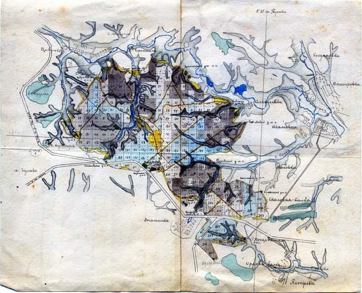
Карта Південно-Західної залізниці Російської імперії
- Date
- 1899
- Place
- Ukraine
- Archive
- Wikimedia Commons
- Type
- map
- Original size
- 600 × 604 pixels
Public domainsafest
Reason: its maker died more than 70 years ago.
Read from: Commons licence category: PD-old-70-expired; no CC BY, CC BY-SA, GFDL or deletion tag on the file page.
Credit line
"Карта Південно-Західної залізниці Російської імперії" (1899). Wikimedia Commons. Public domain. https://commons.wikimedia.org/wiki/File:%D0%9A%D0%B0%D1%80%D1%82%D0%B0_%D0%9F%D1%96%D0%B2%D0%B4%D0%B5%D0%BD%D0%BD%D0%BE-%D0%97%D0%B0%D1%85%D1%96%D0%B4%D0%BD%D0%BE%D1%97_%D0%B7%D0%B0%D0%BB%D1%96%D0%B7%D0%BD%D0%B8%D1%86%D1%96_%D0%A0%D0%BE%D1%81%D1%96%D0%B9%D1%81%D1%8C%D0%BA%D0%BE%D1%97_%D1%96%D0%BC%D0%BF%D0%B5%D1%80%D1%96%D1%97_(1899).jpgNeed maps for a whole project? Add Find Any Map to Claude and ask for this one by its id: 251755.
More like this
Знам'янка, карта кінця 19 століття
January 24, 1890 · Wikimedia Commons

The Kansas, Oklahoma, Central, and Southwestern Railway, South Branch, Cherokee and Creek Nation, Indian Territory
1899 · U.S. National Archives

Мапа Гарадзенскай губэрні (1874) Grodno Governorate map
1874 · Wikimedia Commons

Railway map of south Sweden
1897 · Wikimedia Commons

Carte du Caucase en turc (19th century)
Wikimedia Commons

1854 Map of the Country between Odessa and Constantinople, embracing the Present Seat of War between the Russians and Turks
1854 · Wikimedia Commons

G. Freytags Karte der Westrussischen Kriegsschauplätze
Wikimedia Commons

Map of Viceroyalty of the Caucasus of the Russian Empire
c. 1900 · Wikimedia Commons