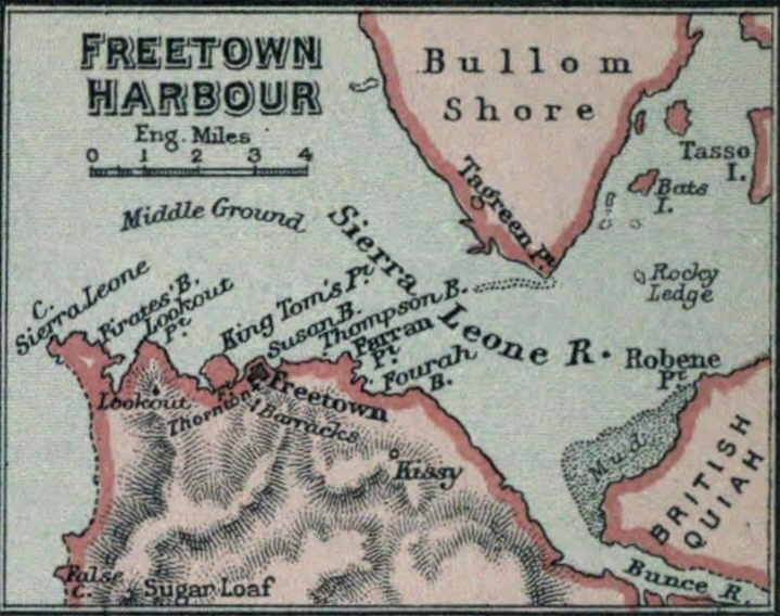

(1894) Map of Freetown Harbour
Map of Freetown Harbour (Sierra Leone)
- Date
- 1894
- Mapmaker / publisher
- Lucas, Charles Prestwood, Sir, (1853-1931)
- Place
- Sierra Leone
- Archive
- Wikimedia Commons
- Type
- map
- Original size
- 719 × 568 pixels
Public domainsafest
Reason: its maker died more than 70 years ago.
Read from: Commons licence category: PD-old-70-expired; no CC BY, CC BY-SA, GFDL or deletion tag on the file page; permission field: Internet Archive Book Images @ Flickr Commons.
Credit line
"(1894) Map of Freetown Harbour" (1894). Lucas, Charles Prestwood, Sir, (1853-1931), via Wikimedia Commons. Public domain. https://commons.wikimedia.org/wiki/File:(1894)_Map_of_Freetown_Harbour.jpgNeed maps for a whole project? Add Find Any Map to Claude and ask for this one by its id: 237178.
More like this

(1894) Map of Freetown
1894 · Wikimedia Commons

IMRAY(1884) p0558 BAY OF FREE TOWN, SIERRA LEONE
1884 · Wikimedia Commons

FORBES(1910) 05 Map of Sierra Leone
1910 · Wikimedia Commons

AFR V3 D256 Freetown - Sierra Leon
June 12, 1892 · Wikimedia Commons

AFR V3 D247 Peninsula of Sierra-Leone
June 12, 1892 · Wikimedia Commons

ROSSER(1869) p0608 SIERRA LEONE
1869 · Wikimedia Commons

(1873) Map Liberia and Sierra Leone
1873 · Wikimedia Commons

Sierra Leone 1898
1898 · Wikimedia Commons