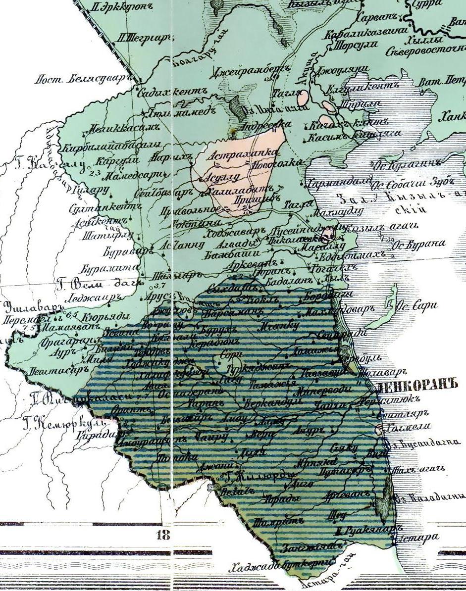

Этнографическая карта Ленкоранского уезда (1880 г.)
- Date
- 1880
- Place
- Russia
- Archive
- Wikimedia Commons
- Type
- map
- Original size
- 941 × 1,194 pixels
Public domainsafest
Reason: its maker died more than 100 years ago, and a faithful scan of a flat work adds no new copyright.
Read from: Commons licence category: PD-Art (PD-old-100); no CC BY, CC BY-SA, GFDL or deletion tag on the file page.
Credit line
"Этнографическая карта Ленкоранского уезда (1880 г.)" (1880). Wikimedia Commons. Public domain. https://commons.wikimedia.org/wiki/File:%D0%AD%D1%82%D0%BD%D0%BE%D0%B3%D1%80%D0%B0%D1%84%D0%B8%D1%87%D0%B5%D1%81%D0%BA%D0%B0%D1%8F_%D0%BA%D0%B0%D1%80%D1%82%D0%B0_%D0%9B%D0%B5%D0%BD%D0%BA%D0%BE%D1%80%D0%B0%D0%BD%D1%81%D0%BA%D0%BE%D0%B3%D0%BE_%D1%83%D0%B5%D0%B7%D0%B4%D0%B0_(1880_%D0%B3.).jpgNeed maps for a whole project? Add Find Any Map to Claude and ask for this one by its id: 241713.
More like this

Ethnographic map of the Baku Governorate
1902 · Wikimedia Commons

The fragment of Lett's Popular Atlas (Russia in Caucasus)
1883 · Wikimedia Commons

Map of the former Sultanate of the Elisu
1868–1881 · Wikimedia Commons

Map of the former Sultanate of Elisu
1868–1881 · Wikimedia Commons

The Border between Europe and Asia in Azerbaijan, T. Letss
October 9, 2023 · Wikimedia Commons

1860. Карта губерний Лифляндской, Эстляндской, Курляндской, Ковенской, Виленской, Гродненской и Минской (этнограф)
1860 · Wikimedia Commons

Khanate of Karabakh in 1823
1823 · Wikimedia Commons

Uyezd of Jabrayil
1907 · Wikimedia Commons