

1861 р. Ходзько Борейко Леонард Стан на 862 р
Map of the Slavic-Polish countries in the 8th and 9th centuries
- Date
- 1861
- Mapmaker / publisher
- Leonard Chodźko
- Place
- ethnic groups in Europe
- Archive
- Wikimedia Commons
- Type
- map
- Original size
- 1,600 × 1,198 pixels
Public domain
Reason: its maker died long enough ago that the copyright has expired.
This status rests on the map's publication history, as researched by Wikimedia Commons. Check it before commercial use.
Read from: Commons licence category: PD Old; no CC BY, CC BY-SA, GFDL or deletion tag on the file page.
Credit line
"1861 р. Ходзько Борейко Леонард Стан на 862 р" (1861). Leonard Chodźko, via Wikimedia Commons. Public domain. https://commons.wikimedia.org/wiki/File:1861_%D1%80.._%D0%A5%D0%BE%D0%B4%D0%B7%D1%8C%D0%BA%D0%BE_%D0%91%D0%BE%D1%80%D0%B5%D0%B9%D0%BA%D0%BE_%D0%9B%D0%B5%D0%BE%D0%BD%D0%B0%D1%80%D0%B4_%D0%A1%D1%82%D0%B0%D0%BD_%D0%BD%D0%B0_862_%D1%80.jpgNeed maps for a whole project? Add Find Any Map to Claude and ask for this one by its id: 252231.
More like this

CHODZKO(1861) CARTE DES PAYS SLAVO-POLONAIS AUX VIII ET IX SIECLE
1861 · Wikimedia Commons

LELEWEL(1846) Polen im Jahr 992
1846 · Wikimedia Commons

Spruner-Menke Hand-Atlas für die Geschichte des Mittelalters und der neueren Zeit.
Wikimedia Commons

Central Europe in Carolingian times
1886 · Wikimedia Commons
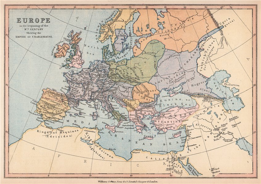
'Europe in the beginning of the 9th Century', 1878 map
1878 · Wikimedia Commons

F.W. Putzgers Historischer Schul-Atlas: zur alten, mittleren und neuen Geschichte: in 66 Haupt- und 63 Nebenkarten
Wikimedia Commons

Polen und Litauen 1125 bis zu ihrer Vereinigung 1386
1854 · Wikimedia Commons

Germanisch-Slawisch-Ungarisches Mitteleuropa um 1000
Wikimedia Commons