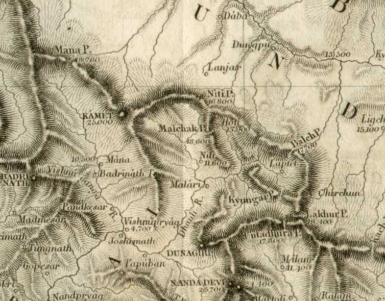

1851 map of Barahoti area Strachey
Shows the:w:Barahoti area currently disputed between China and India
- Date
- 1951
- Mapmaker / publisher
- Henry Strachey
- Place
- Uttarakhand
- Archive
- Wikimedia Commons
- Type
- map
- Original size
- 754 × 590 pixels
Public domain
Reason: its maker died more than 70 years ago.
This status rests on the map's publication history, as researched by Wikimedia Commons. Check it before commercial use.
Read from: Commons licence category: PD-old-70-expired; no CC BY, CC BY-SA, GFDL or deletion tag on the file page.
Credit line
"1851 map of Barahoti area Strachey" (1951). Henry Strachey, via Wikimedia Commons. Public domain. https://commons.wikimedia.org/wiki/File:1851_map_of_Barahoti_area_Strachey.jpgNeed maps for a whole project? Add Find Any Map to Claude and ask for this one by its id: 257287.
More like this

1851 Himalaya Mountains by Strachey
1851 · Wikimedia Commons

1900 map of Barahoti area Strachey
1900 · Wikimedia Commons

1900 Northern Border of Kumaon
1900 · Wikimedia Commons

1959 India's Frontier with China by Indian Ministry of External Affairs
1959 · Wikimedia Commons

This map shows the three Bhotiya valleys of Kumaon: Beeans (Byans), Dharma (Darma) and Juwahir (Johar), and the region of Chaudans, which is the central section of the Kali River valley. Surveyed by W
1819 · Wikimedia Commons

Southern Chumbi Valley and adjacent territories (Richard Temple, 1881)
1881 · Wikimedia Commons

1919 Survey of India map of Tibet and Adjacent Countries
1919 · Wikimedia Commons

1945 McMahon Area--Map No 5 from Tibetan Precis
1945 · Wikimedia Commons