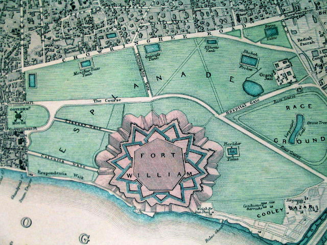

1844 Map of Fort William and Esplanade
Fort William in its context, in an SDUK ("Society for the Diffusion of Useful Knowledge") map from 1844
- Date
- 1844
- Mapmaker / publisher
- Society for the Diffusion of Useful Knowledge
- Place
- Kolkata
- Archive
- Wikimedia Commons
- Type
- map
- Original size
- 640 × 480 pixels
Public domain
Reason: its maker died long enough ago that the copyright has expired.
This status rests on the map's publication history, as researched by Wikimedia Commons. Check it before commercial use.
Read from: Commons licence category: PD Old; no CC BY, CC BY-SA, GFDL or deletion tag on the file page.
Credit line
"1844 Map of Fort William and Esplanade" (1844). Society for the Diffusion of Useful Knowledge, via Wikimedia Commons. Public domain. https://commons.wikimedia.org/wiki/File:1844_Map_of_Fort_William_and_Esplanade.jpgNeed maps for a whole project? Add Find Any Map to Claude and ask for this one by its id: 256936.
More like this

This is a S.D.U.K. map or city plan of Calcutta, India. Calcutta was once the administrative capital of British India. The lower part of the map is decorated by several beautiful engraved illustration
1842 · 1842 S.D.U.K. Map of the City of Calcutta

Kolkata Old Map
1784 · Wikimedia Commons

Fort William, Calcutta
Wikimedia Commons

Map of the presidency town of Calcutta from Imperial Gazetteer of India, volume 26, Atlas, Oxford University Press. 1908. Scanned from personal copy, reduced, and uploaded by Fowler&fowler «Talk» 21:5
1908 · Wikimedia Commons

Calcutta (Baedeker, 1914)
1914 · Wikimedia Commons

Plan of Calcutta from actual survey
January 20, 1858 · Wikimedia Commons

Calcutta map 1832
1832 · Wikimedia Commons

Map of Calcutta from The Imperial Gazetteer of India (1907-1909)
1907–1909 · Wikimedia Commons