

1640 Map of Formosa-Taiwan by Dutch 荷蘭人所繪福爾摩沙-臺灣
The Island Formosa and the Pescadores
- Date
- c. 1640
- Place
- Taiwan
- Archive
- Wikimedia Commons
- Type
- atlas page
- Original size
- 8,168 × 5,640 pixels
Public domainsafest
Reason: its maker died more than 100 years ago.
Read from: Commons licence category: PD-old-100-expired; no CC BY, CC BY-SA, GFDL or deletion tag on the file page.
Credit line
"1640 Map of Formosa-Taiwan by Dutch 荷蘭人所繪福爾摩沙-臺灣" (c. 1640). Wikimedia Commons. Public domain. https://commons.wikimedia.org/wiki/File:1640_Map_of_Formosa-Taiwan_by_Dutch_%E8%8D%B7%E8%98%AD%E4%BA%BA%E6%89%80%E7%B9%AA%E7%A6%8F%E7%88%BE%E6%91%A9%E6%B2%99-%E8%87%BA%E7%81%A3.jpgNeed maps for a whole project? Add Find Any Map to Claude and ask for this one by its id: 240413.
More like this

The Island Formosa and the Pescadores
c. 1640 · Wikimedia Commons

Het Eyland Formosa & Pisca Dores
1636 · Wikimedia Commons

Map of the Western Coast of Taiwan, Tayouan and Points North, c. 1636
1636 · Wikimedia Commons

AMH-6670-NA Map of the island of Formosa
c. 1665 · Wikimedia Commons

Atlas Blaeu-Van der Hem - Taioan
1644–2013 · Wikimedia Commons

1570-1612 Map of Formosa (Taiwan) and Surrounding Countries by Dutch Flemish 荷屬佛萊明人(今比利時北部)所繪福爾摩沙臺灣
1570 · Wikimedia Commons
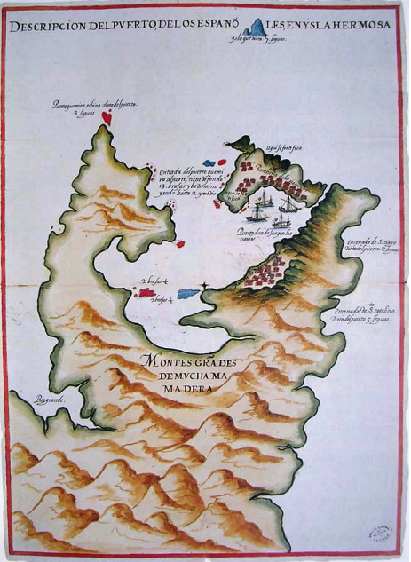
1626 Map of Keelung and Tamsui Harbor, Formosa-Taiwan by Spanish 西班牙人所繪福爾摩沙基隆港與淡水港
1626 · Wikimedia Commons

Bird's-Eye View of Fort Zeelandia and Warehouses, 1635
1635 · Wikimedia Commons